In 2012, water managers in Fredericktown, Missouri, saw their city's main source ...
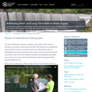
In 2012, water managers in Fredericktown, Missouri, saw their city's main source of water dwindle. They used the EPAs Climate Ready Water Utilities program to consider options and develop plans to protect their water source.
Learning and Understanding Mathematical Concepts in the Areas of Water Distribution and ...
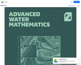
Learning and Understanding Mathematical Concepts in the Areas of Water Distribution and Water Treatment. From College of the Canyons.
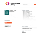
Table of Contents Section 1: Unit Dimensional Analysis Section 2: Geometric Shapes Section 3: Density and Specific Gravity Section 4: Chemical Dosage Analysis Section 5: Weir Overflow Rate Section 6: Water Treatment Math Detention Time Section 7: CT Calculations Section 8: Pressure, Head Loss, and Flow Section 9: Well Yield, Specific Capacity, and Drawdown Section 10: Horsepower and Efficiency Section 11: Per Capita Water Usage Section 12: Blending and Diluting Section 13: Scada and the Use of mA Section 14: Water Utility Management
Anteprima del volume "I BACINI CULTURALI E LA PROGETTAZIONE SOCIALE ORIENTATA ALL’HERITAGE-MAKING, TRA ...
Anteprima del volume "I BACINI CULTURALI E LA PROGETTAZIONE SOCIALE ORIENTATA ALL’HERITAGE-MAKING, TRA POLITICHE GIOVANILI, INNOVAZIONE SOCIALE, DIVERSITÀ CULTURALE. Il framework del Progetto ABACUS – Attivazione dei Bacini Culturali Siciliani, alla luce della Convenzione Quadro del Consiglio d'Europa sul valore del Patrimonio culturale per la società"
O aplicativo GeoSensor é o produto técnico da dissertação de mestrado intitulada: ...
O aplicativo GeoSensor é o produto técnico da dissertação de mestrado intitulada: App GeoSensor, Geotecnologias Aplicadas ao Ensino das Ciências Ambientais, apresentada ao Programa de Pós-Graduação em Rede Nacional para Ensino das Ciências Ambientais – Profciamb, núcleo UFPA. O app foi concebido como uma forma de disseminar conhecimentos em Geotecnologias, de maneira didática e acessível, além de fazer paralelo com conhecimentos de disciplinas curriculares, como matemática, física e química, de modo a servir como incentivo ao Ensino de Ciências Ambientais, despertando o interesse dos alunos, utilizando exemplos de aplicações práticas de conceitos vistos em sala de aula, além de possibilitar aos educadores demonstrar as aplicações do conhecimento obtido em sala na vida de todos. O aplicativo foi desenvolvido tendo como público-alvo discentes e docentes do ensino médio, com possibilidades de aplicação também a partir do ensino fundamental 2, bem como em níveis técnico e superior.
The city of Fort Collins, Colorado, found a win-win solution to problems ...
The city of Fort Collins, Colorado, found a win-win solution to problems it faced with 100 acres of abandoned property. The city now enjoys new green space, improved floodwater management, and a boosted economy.
When water utility personnel recognized their groundwater withdrawals were damaging ecosystems in ...
When water utility personnel recognized their groundwater withdrawals were damaging ecosystems in the Tampa Bay area, they found new ways to reduce their dependence on it.
It's not easy to keep faucets flowing year-round in southwest Florida. To ...
It's not easy to keep faucets flowing year-round in southwest Florida. To make sure their customers can get ample clean water at a good priceeven through dry seasonswater utility managers crafted a useful index to help them decide which water sources to use.
Rapid changes at Earth's surface, largely in response to human activity, have ...
Rapid changes at Earth's surface, largely in response to human activity, have led to the realization that fundamental questions remain to be answered regarding the natural functioning of the Critical Zone, the thin veneer at Earth's surface where the atmosphere, lithosphere, hydrosphere and biosphere interact. EARTH 530 will introduce you to the basics necessary for understanding Earth surface processes in the Critical Zone through an integration of various scientific disciplines. Those who successfully complete EARTH 530 will be able to apply their knowledge of fundamental concepts of Earth surface processes to understanding outstanding fundamental questions in Critical Zone science and how their lives are intimately linked to Critical Zone health.
Our planet is becoming hot. In fact, Earth may be warming faster ...
Our planet is becoming hot. In fact, Earth may be warming faster than ever before. This warming will challenge society throughout the 21st century. How do we cope with rising seas? How will we prepare for more intense hurricanes? How will we adapt to debilitating droughts and heat waves? Scientists are striving to improve predictions of how the environment will change and how it will impact humans. Earth in the Future: Predicting Climate Change and Its Impacts Over the Next Century is designed to provide the state of the art of climate science, the impact of warming on humans, as well as ways we can adapt. Every student will understand the challenges and opportunities of living in the 21st century.
In Massachusetts, Manchester-by-the-Sea's wastewater treatment plant is located right on the coast. ...
In Massachusetts, Manchester-by-the-Sea's wastewater treatment plant is located right on the coast. The town's water utility is working with the EPA's Climate Ready Water Utilities program to consider its adaptation options.
Geography 431 is designed to further understanding of the natural processes of ...
Geography 431 is designed to further understanding of the natural processes of aquatic ecosystems, management of water resources, and threats to sustaining water quantity. Develop awareness and appreciation of the perspectives about water as a precious resource, commodity, and sometimes hazard. Learn how and why water is distributed unevenly around the Earth. Examine how resource management decisions are strongly related to water availability, quantity, and quality. The course examines water resources management; dams and dam removal; provision of safe potable water; threats to water quantity and quality; land use changes; the water economy; water laws and policy; institutions for water management at the global, national, regional, and local scale; and issues of water security and climate change.
Faced with the potential of a large expense related to water quality, ...
Faced with the potential of a large expense related to water quality, the Portland (Maine) Water District performed a thorough analysis of their options. Their choice came down to making an investment in conservation or concrete.
Este guia trabalha elementos de análise para facilitar aos professores a escolha ...
Este guia trabalha elementos de análise para facilitar aos professores a escolha do livro didático de Biologia no Ensino Médio que efetivamente promovam a Educação Ambiental, podendo ainda, ser utilizado para os demais componentes curriculares da educação básica.
This classroom activity allows students to use water surface temperature, bathymetric data ...
This classroom activity allows students to use water surface temperature, bathymetric data and weather data to look at trends in the water temperature of the Great Lakes. The exercise asks students to make predictions, and then use the data to answer questions. The site contains everything that is needed for the exercise, including student handouts, maps, links to data sources, and background information and questions for discussion.
HydroViz is an educational "virtual" hydrologic observatory developed for a "real" watershed ...
HydroViz is an educational "virtual" hydrologic observatory developed for a "real" watershed and is based on integration of field data, remote sensing observations and computer simulations of hydrologic variables and processes. The main purpose of HydroViz is to support hydrology education in engineering and earth science courses.
Relation of purpose of data to data requirements. Relation of data to ...
Relation of purpose of data to data requirements. Relation of data to costs. Accuracy requirements of measurements and error propagation: Related to a problem the required accuracy of measurements and the consequences for accuracy in the final result are discussed. Different types of errors are handled. Propagation of errors; for dependent and independent measurements, from mathematical relations and regression is demonstrated. Recapitulated is the theory of regression and correlation. Interpretation of measurements, data completion: By standard statistical methods screening of measured data is performed; double mass analysis, residual mass, simple rainfall-runoff modelling. Detection of trends; split record tests, Spearman rank tests. Methods to fill data gaps and do filtering on data series for noise reduction. Methods of hydrological measurements and measuring equipment: To determine quantitatively the most important elements in the hydrological cycle an overview is presented of most common hydrological measurements, measuring equipment and indirect determination methods i.e. for precipitation, evaporation, transpiration, river discharge and groundwater tables. Use, purpose and measurement techniques for tracers in hydrology is discussed. Advantages and disadvantages and specific condition/application of methods are discussed. Equipment is demonstrated and discussed. Areal distributed observation: Areal interpolation techniques of point observations: inverse distance, Thiessen, contouring, Kriging. Comparison of interpolation techniques and estimation of errors. Correlation analysis of areal distributed observation of rainfall Design of measuring networks: Based on correlation characteristics from point measurements (e.g. rainfall stations) and accuracy requirements the design of a network of stations is demonstrated.
-De hydrologie van Nederland in historisch perspectief en de rol van de ...
-De hydrologie van Nederland in historisch perspectief en de rol van de mens daarin (de vroege geschiedenis; waterbeheersing van af het begin van de 17e eeuw; grote werken);-Hydrologie van Nederland (geologie; neerslag en verdamping; oppervlaktewater; gro
This course, is designed to be a descriptive and analytical overview of ...
This course, is designed to be a descriptive and analytical overview of water organs, availability, location and flow. It will be examined in the light of problems, possibilities and policy and consider historical perspectives.
No restrictions on your remixing, redistributing, or making derivative works. Give credit to the author, as required.
Your remixing, redistributing, or making derivatives works comes with some restrictions, including how it is shared.
Your redistributing comes with some restrictions. Do not remix or make derivative works.
Most restrictive license type. Prohibits most uses, sharing, and any changes.
Copyrighted materials, available under Fair Use and the TEACH Act for US-based educators, or other custom arrangements. Go to the resource provider to see their individual restrictions.