The Taconic Mountains tour highlights the geology and natural environment of several …
The Taconic Mountains tour highlights the geology and natural environment of several landscape regions, including the structure of the Highlands Province basement rocks, which were affected by the Taconic Orogeny. Students can view biotite-rich schists and the tight isoclinic folds of the Walloomsac Formation, as well as the Taconic angular unconformity at the south end of Becraft Mountain. Bedding thrusts are also evident within the Roundout Formation and overlying Manlius Formation. They can also examine metamorphosed Briarcliff Dolostone containing yellow, white and black chert layers and Everett Phylite, which represents a metamorphic lithologic transition from slate to phyllite. Dramatically folded calcareous rocks are visible at the Bennington, Vermont bypass, and students can also view Stark's Knob, where pillow lavas formed as Ordovician basalts erupted under the waters of a shallow sea.
The Manhattan Prong tour is part of the New York Landscape Regions …
The Manhattan Prong tour is part of the New York Landscape Regions Collection of Google Earth Tours. This tour takes students to Central Park in New York City to see metamorphic rock, glacial features, differential weathering, and Cleopatra's Needle, an Egyptian obelisk brought to the city in 1881. They can also examine bedrock, float, mass wasting, jointing, and glacial polish in the Pound Ridge Reservation, and observe a metamorphic outcrop of Fordham Gneiss near Katonah, New York. The convergent boundary features of the Staten Island serpentine belt, formed during the Taconic Orogeny, can be viewed, and students can follow the Mianus River Gorge as it crosses the Cameron's Line fault. There is also a tour of the New York City water supply system with a lab activity to accompany it.
The Tug Hill Plateau tour is part of the New York Landscape …
The Tug Hill Plateau tour is part of the New York Landscape Regions Collection of Google Earth Tours, created by a group of New York State science educators. The tour introduces students to the many waterfalls of the plateau, which is formed of layers of sandstone and shale. It also points out that the plateau recieves more snow than any location east of the Rocky Mounatins due to the lake-effect from Lake Ontario and its elevation, which is 2,100 feet at the highest point. There is also a visit to a fish hatchery.
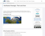
In this lesson, students learn about some of the early explorations of …
In this lesson, students learn about some of the early explorations of the Northwest Passage, and how the changing sea ice extent has prompted new explorations of this region to transport goods from one region of the Northern Hemisphere to another.
The purpose of this resource is to help students understand the connection …
The purpose of this resource is to help students understand the connection between remote sensing, computer imagery, and land cover assessment. Students translate their maps created in the beginning activity into digital code and exchange the digitized versions of their maps with students in another school.
The purpose of this resource is to familiarize students with the importance …
The purpose of this resource is to familiarize students with the importance of perspective and various scales of remotely sensed data. Students create a 3-D model of an area and develop a classification system for the landforms in their model. The maps can then be used to answer certain questions about the environment.
The purpose of this resource is to familiarize students with modeling as …
The purpose of this resource is to familiarize students with modeling as it relates to remote sensing and digitized images. Students will use the symbolic map created in the beginning activity to produce a digitized image and begin to see why ground verification of satellite data is necessary.
Updated Fall 2023 This textbook was designed especially for Community College students, …
Updated Fall 2023
This textbook was designed especially for Community College students, as a resource to instill the knowledge and adventure that the discipline of geography holds for so many of us. The following units will cover a wide array of topics such as: Earth’s grid system, weather, climate, rivers, oceans, deserts, basic geology, and cartography. This book also integrates virtual field trips and interactive multimedia.
The Text Has 19 units; Unit 1: Introduction to Geography as a Discipline Unit 2: Earth’s Place within the Cosmos Unit 3: Introduction to Geology & Geologic Time Unit 4: Mapping Earth’s Surface Unit 5: Earth-Sun Relationships: Reasons for the Seasons Unit 6: Earth’s Atmosphere Unit 7: Elements of Weather & Climate Unit 8: Basic Mineral Development Unit 9: Igneous Rocks Unit 10: Sedimentary Rocks Unit 11: Metamorphism & Metamorphic Rocks Unit 12: Weathering & Soils Unit 13: Earths Dynamic Surface: Plate Tectonics Unit 14: Earths Dynamic Surface: Tectonics Force Unit 15: Earths Dynamic Surface: Volcanoes Unit 16: Shaped by Coastal Processes Unit 17: Shaped by Rivers & Running Water Unit 18: Shaped by Wind as a Geomorphic Agent Unit 19: Shaped by Glaciers
Twenty lab exercises for undergraduate-level physical geography laboratory courses. Lab manual highlights include: Customizable components to suit your needs for synchronous, asynchronous, or face-to-face instruction; Meets the C-ID descriptor requirements for content, lab activities, and objectives while including geotechnology applications and environmental justice topics where appropriate; Each lab exercise underwent peer review to ensure clarity, currency, and utility.
In-house assessments designed for use with a revised edition of Lumen Learning's …
In-house assessments designed for use with a revised edition of Lumen Learning's Physical Geography textbook (https://courses.lumenlearning.com/chemeketa-geophysical/).
Catalog course description: Focuses on the physical subsystems of the earth (atmosphere, biosphere, hydrosphere, and lithosphere), with emphasis on human-environment relations. Includes basic map skills, latitude/longitude, weather, climate, biogeography, volcanism, erosion, and desert landscapes.
In the final lesson of the SDO curriculum, student teams collaborate to …
In the final lesson of the SDO curriculum, student teams collaborate to design and present their three Solar Module activities as part of their 3-D Solar Exhibit summative assessment.
This animation adapted from NASA shows the orbital paths of spacecraft in …
This animation adapted from NASA shows the orbital paths of spacecraft in NASA's Earth Observing Fleet that are a source of wide-scale, primary research about Earth.
The purpose of this resource is to investigate the center pixel of …
The purpose of this resource is to investigate the center pixel of a homogeneous land Cover Site in order to understand that individual land areas are part of a larger land system.
In this activity, students create two- and three-dimensional maps by using a …
In this activity, students create two- and three-dimensional maps by using a data grid of an imaginary section of Earth's surface. They are challenged to create six different maps of various surface features and answer questions about them.
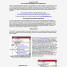
This user's manual describes the steps for using Google Earth tours. Topics …
This user's manual describes the steps for using Google Earth tours. Topics include downloading and installing Google Earth software, selecting a tour file, and playing the tour. There are also instructions on how to use some of Google Earth's additional features. A downloadable, printable version is provided.
This interactive resource adapted from the National Park Service illustrates the variety …
This interactive resource adapted from the National Park Service illustrates the variety of landforms and features created by volcanoes. Featured are calderas, craters, fumaroles and other geothermal features, igneous rocks, lava flows, lava tubes, and maars.
No restrictions on your remixing, redistributing, or making derivative works. Give credit to the author, as required.
Your remixing, redistributing, or making derivatives works comes with some restrictions, including how it is shared.
Your redistributing comes with some restrictions. Do not remix or make derivative works.
Most restrictive license type. Prohibits most uses, sharing, and any changes.
Copyrighted materials, available under Fair Use and the TEACH Act for US-based educators, or other custom arrangements. Go to the resource provider to see their individual restrictions.