The purpose of this resource is to observe budburst on selected trees …
The purpose of this resource is to observe budburst on selected trees at a Land Cover or Phenology Site. All students will learn about hummingbird natural history and ecology. Students will learn how to identify and age male and female Ruby-throated Hummingbirds and to observe migration and feeding behavior. Students will learn how to make connections among hummingbird behavior and weather, climate, food availability, seasonality, photoperiod (day length), and other environmental factors.
Rapid changes at Earth's surface, largely in response to human activity, have …
Rapid changes at Earth's surface, largely in response to human activity, have led to the realization that fundamental questions remain to be answered regarding the natural functioning of the Critical Zone, the thin veneer at Earth's surface where the atmosphere, lithosphere, hydrosphere and biosphere interact. EARTH 530 will introduce you to the basics necessary for understanding Earth surface processes in the Critical Zone through an integration of various scientific disciplines. Those who successfully complete EARTH 530 will be able to apply their knowledge of fundamental concepts of Earth surface processes to understanding outstanding fundamental questions in Critical Zone science and how their lives are intimately linked to Critical Zone health.
Increasingly volatile climate and weather; vulnerable drinking water supplies; shrinking wildlife habitats; …
Increasingly volatile climate and weather; vulnerable drinking water supplies; shrinking wildlife habitats; widespread deforestation due to energy and food production. These are examples of environmental challenges that are of critical importance in our world, both in far away places and close to home, and are particularly well suited to inquiry using geographic information systems. In GEOG 487 you will explore topics like these and learn about data and spatial analysis techniques commonly employed in environmental applications. After taking this course you will be equipped with relevant analytical approaches and tools that you can readily apply to your own environmental contexts.
This video highlights students taking scientific measurements to support investigations in atmospheric …
This video highlights students taking scientific measurements to support investigations in atmospheric science, hydrology, soils, and land cover. It shows students reporting data through the Web, creating scientific visualizations for analysis, and collaborating with students and scientists around the world. This is one two introductory videos in the 24-part GLOBE video series. GLOBE (Global Learning and Observation to Benefit the Environment) is a worldwide, hands-on, K-12 school-based science education program.
This video highlights students taking scientific measurements to support investigations in atmospheric …
This video highlights students taking scientific measurements to support investigations in atmospheric science, hydrology, soils, and land cover. It shows students reporting data through the Web, creating scientific visualizations for analysis, and collaborating with students and scientists around the world. This is one of two introductory videos in the 24-part GLOBE video series. GLOBE (Global Learning and Observation to Benefit the Environment) is a worldwide, hands-on, K-12 school-based science education program.
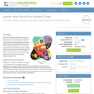
In this lesson, students will learn about types of land use by …
In this lesson, students will learn about types of land use by humans and evaluate the ways land is used in their local community. They will also consider the environmental effects of the different types of land use. Students will assume the role of community planning engineers and will create a future plan for their community. (Note: Teachers will need to check out the following book from the local or school library: Durell, Ann, Craighead George, Jean, and Paterson, Katherine. The Big Book For Our Planet, New York: Dutton Children's Books, 1993).
The purpose of the resource is to investigate changes in the major …
The purpose of the resource is to investigate changes in the major land cover types of Study Sites by examining Landsat satellite images acquired years apart.
The purpose of this resource is to develop a classification system for …
The purpose of this resource is to develop a classification system for a set of objects and learn about hierarchical classification systems. Any set of objects, such as insects or rocks, may be used as well.
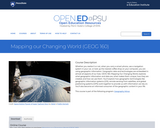
Whether you realize it or not, when you carry a smart phone, …
Whether you realize it or not, when you carry a smart phone, use a navigation system in your car, or look up the nearest coffee shop on your computer, you are using geographic information. Geographic data and technologies are embedded in almost all aspects of our lives. GEOG 160, Mapping Our Changing World, explores what geographic information and data are, what makes them unique, how they are created, and how we use them. You'll explore how geographic technologies like geographic information systems (GIS), remote sensing from satellites, and global positioning systems (GPS) work together to provide us with information we rely on. You'll also become an informed consumer of the geographic content in your life.
The purpose of this resource is to help students understand the connection …
The purpose of this resource is to help students understand the connection between remote sensing, computer imagery, and land cover assessment. Students translate their maps created in the beginning activity into digital code and exchange the digitized versions of their maps with students in another school.
The purpose of this resource is to familiarize students with the importance …
The purpose of this resource is to familiarize students with the importance of perspective and various scales of remotely sensed data. Students create a 3-D model of an area and develop a classification system for the landforms in their model. The maps can then be used to answer certain questions about the environment.
The purpose of this resource is to familiarize students with modeling as …
The purpose of this resource is to familiarize students with modeling as it relates to remote sensing and digitized images. Students will use the symbolic map created in the beginning activity to produce a digitized image and begin to see why ground verification of satellite data is necessary.
No restrictions on your remixing, redistributing, or making derivative works. Give credit to the author, as required.
Your remixing, redistributing, or making derivatives works comes with some restrictions, including how it is shared.
Your redistributing comes with some restrictions. Do not remix or make derivative works.
Most restrictive license type. Prohibits most uses, sharing, and any changes.
Copyrighted materials, available under Fair Use and the TEACH Act for US-based educators, or other custom arrangements. Go to the resource provider to see their individual restrictions.