Updating search results...

Search Resources

4335 Results

View
Selected filters:
  • geoscience
Advanced exploration of the ecological consequences of trophic downgrading in mixed/short grass prairies in North America
Conditional Remix & Share Permitted
CC BY-NC-SA
Rating
0.0 stars

North American ecosystems have fundamentally changed over the late Pleistocene and Holocene; from a system dominated by mammoths, to bison, to domestic livestock. Given the very different body size and herd formation of these 'ecosystem engineers', it is likely that animals influence soil structure, water tables, vegetation and other animals in the ecosystems. What has been the ecological influence of the continued 'downsizing' of the largest animals in the ecosystem?

(Note: this resource was added to OER Commons as part of a batch upload of over 2,200 records. If you notice an issue with the quality of the metadata, please let us know by using the 'report' button and we will flag it for consideration.)
Subject:
Applied Science
Biology
Environmental Science
History
Information Science
Life Science
Mathematics
Measurement and Data
Material Type:
Activity/Lab
Provider:
Science Education Resource Center (SERC) at Carleton College
Provider Set:
Teach the Earth
Author:
Dennis Ruez
Date Added:
09/26/2022
Advanced steronet -finding rotation axes
Conditional Remix & Share Permitted
CC BY-NC-SA
Rating
0.0 stars

Using stereonets to find rotation axes of tilted planes. Paleomagnetic vectors used as indicators of rotations of dikes and planes.

(Note: this resource was added to OER Commons as part of a batch upload of over 2,200 records. If you notice an issue with the quality of the metadata, please let us know by using the 'report' button and we will flag it for consideration.)
Subject:
Biology
Life Science
Mathematics
Measurement and Data
Material Type:
Activity/Lab
Provider:
Science Education Resource Center (SERC) at Carleton College
Provider Set:
Teach the Earth
Author:
Steve Hurst
Date Added:
08/29/2019
Adventures in ABC & 1, 2, 3
Conditional Remix & Share Permitted
CC BY-NC-SA
Rating
0.0 stars

This activity is an indoor/outdoor activity that incorporates both literacy and scientific observation to make an ABC book based on Antler, Bear, Canoe by Betsy Bowen. Family participation is encouraged.

Subject:
Applied Science
Environmental Science
Material Type:
Activity/Lab
Lesson Plan
Provider:
Science Education Resource Center (SERC) at Carleton College
Provider Set:
Pedagogy in Action
Author:
Julie Roettger
Date Added:
10/04/2011
Adventures in ABC and 1,2,3
Conditional Remix & Share Permitted
CC BY-NC-SA
Rating
0.0 stars

This activity is an indoor/outdoor activity that incorporates both literacy and scientific observation to make an ABC book based on Antler, Bear, Canoe by Betsy Bowen.

Subject:
Applied Science
Environmental Science
Material Type:
Activity/Lab
Lesson Plan
Provider:
Science Education Resource Center (SERC) at Carleton College
Provider Set:
Pedagogy in Action
Date Added:
01/20/2012
AdÃlie Penguins
Read the Fine Print
Rating
0.0 stars

A short video that discusses how changing climate is affecting the population of AdÃlie penguins.

Subject:
Applied Science
Biology
Career and Technical Education
Ecology
Environmental Science
Environmental Studies
Life Science
Physical Science
Provider:
CLEAN: Climate Literacy and Energy Awareness Network
Provider Set:
CLEAN: Climate Literacy and Energy Awareness Network
Author:
NOAA (National Oceanic and Atmospheric Administration)
Date Added:
09/24/2018
Aeolian Processes
Conditional Remix & Share Permitted
CC BY-NC-SA
Rating
0.0 stars

This activity explores the environmental variables that influence wind erosion.

Key words: aeolian, fluid threshold, impact threshold,sedeiment entrainment and transport, particle size analysis

(Note: this resource was added to OER Commons as part of a batch upload of over 2,200 records. If you notice an issue with the quality of the metadata, please let us know by using the 'report' button and we will flag it for consideration.)
Subject:
Biology
Life Science
Material Type:
Activity/Lab
Provider:
Science Education Resource Center (SERC) at Carleton College
Provider Set:
Teach the Earth
Author:
Alec Aitken
Date Added:
09/03/2019
Aerial Photography and Mapping Lesson Plan: Images of Katrina
Read the Fine Print
Rating
0.0 stars

This activity from NOAA Ocean Service is about using aerial photographs to assess the impact of extreme weather events such as Hurricane Katrina. The activity features aerial views of Biloxi, MS post-Katrina and enables students to see evidence of the power of extreme weather on the environment.

Subject:
Geoscience
Physical Science
Material Type:
Activity/Lab
Provider:
CLEAN: Climate Literacy and Energy Awareness Network
Provider Set:
CLEAN: Climate Literacy and Energy Awareness Network
Author:
NOAA
Date Added:
10/27/2014
Aerial photo interpretation and mapping - Bayou Meda anticline, Arkansas
Conditional Remix & Share Permitted
CC BY-NC-SA
Rating
0.0 stars

Students use aerial photography combined with field observation to interpret the geology of a megascopic anticline-syncline pair exposed in the Ouachita Mountains of central Arkansas. This project focuses on the integration of remotely-sensed data with direct observation to develop and test hypotheses regarding the geology and structure of a well-defined field area. Students construct a geological map and cross-section that synthesize their observations and illustrate the geology of the field area.

(Note: this resource was added to OER Commons as part of a batch upload of over 2,200 records. If you notice an issue with the quality of the metadata, please let us know by using the 'report' button and we will flag it for consideration.)
Subject:
Biology
Geology
Life Science
Physical Science
Material Type:
Activity/Lab
Provider:
Science Education Resource Center (SERC) at Carleton College
Provider Set:
Teach the Earth
Author:
Jamey Jones
Date Added:
09/09/2020
Afghan Poppies, Climate Change and War: Thinking Systemically About Us and Them
Conditional Remix & Share Permitted
CC BY-NC-SA
Rating
0.0 stars

This contemplative practice inquires into the complex web of interdependencies linking global climate change, the War on Terror, Afghan poppy production, opiate addiction, and food security through the lens of systems theory. The exercise challenges students to consider these linkages not only conceptually but also somatically and emotionally.

(Note: this resource was added to OER Commons as part of a batch upload of over 2,200 records. If you notice an issue with the quality of the metadata, please let us know by using the 'report' button and we will flag it for consideration.)
Subject:
Applied Science
Environmental Science
Material Type:
Activity/Lab
Provider:
Science Education Resource Center (SERC) at Carleton College
Provider Set:
Teach the Earth
Author:
Karen Litfin
Date Added:
12/01/2021
After-School Educator's Guide to OLogy: Paleontology
Read the Fine Print
Rating
0.0 stars

This comprehensive guide to the Paleontology section of OLogy, the Museum's science Web site for kids, explains how after-school educators can make the most of the site. It focuses on dinosaurs because that's what kids are most familiar with. An introduction to the Big Ideas in Paleontology brings educators up to speed on how scientists study early life on Earth, what kind of information the fossil record contains, and why dinosaurs are not extinct. A Site Map shows where to locate all Paleontology resources, from stories to quizzes to hands-on-activities. Paleontology units offer ways to combine different types of resources around a topic. Follow-up questions encourage inquiry-based learning. Wrap-Up Paleo Projects suggests fun ways to wrap up any of these units. A Links and Resources section lists recommended paleontology-related books and Web sites for educators and for kids. A glossary of paleontological terms wraps up the guide.

Subject:
Education
Geoscience
Life Science
Physical Science
Material Type:
Lesson Plan
Provider:
American Museum of Natural History
Provider Set:
American Museum of Natural History
Date Added:
10/15/2014
Aging Diamonds?
Read the Fine Print
Educational Use
Rating
0.0 stars

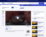
In this video from Nature, geological detectives use ancient diamonds to learn more about Earth's inner layers.

Subject:
Chemistry
Geoscience
Physical Science
Space Science
Material Type:
Lecture
Provider:
PBS LearningMedia
Provider Set:
PBS Learning Media: Multimedia Resources for the Classroom and Professional Development
Author:
Canon
Corporation for Public Broadcasting
SC Johnson
WNET
Date Added:
11/11/2008
Air: Fuel for Thought
Unrestricted Use
CC BY
Rating
0.0 stars

This lesson plan engages students in a real-life exploration of climate change as it is affected by greenhouse emissions from vehicles. The aim of this activity is for students to realize the impact of vehicle use in their family and to give students the opportunity to brainstorm viable alternatives to this use.

Subject:
Physical Science
Material Type:
Activity/Lab
Provider:
CLEAN: Climate Literacy and Energy Awareness Network
Provider Set:
CLEAN: Climate Literacy and Energy Awareness Network
Author:
PBS
Date Added:
06/19/2012
Air Particulate Analysis
Conditional Remix & Share Permitted
CC BY-NC-SA
Rating
0.0 stars

Phase 1: Definition of Projects and Research Teams (Homework +1 Class)

Each student is assigned the task of proposing a site to investigate within the city and the surrounding region. Students are encouraged to discuss the assignment with community members for suggestions and inspiration. Each student will produce an easel-size poster of their proposal highlighting the following:


Site location;

Reasons for selecting this site;

Potential interest to the community;

Potential logistical problems associated with the proposed site/project.

Posters will be hung in a gallery-walk format, and each student will mark the location of their proposed study site on the classroom map of New York City. The class is given time to read and comment on each of their peers' proposals, after which the instructor will lead a class discussion of the interests, merits, and obstacles associated with each proposal, with the goal of having the class settle on the set of projects on which to move forward.
Students will define groups of 2 to 4 students per project. If more than 4 students are interested in the same site, then multiple groups may develop parallel projects.

Phase 2: Data Collection and Analysis (5 weeks)

In consultation with the instructor, teams develop and implement a sampling protocol, including the documentation of terrain, human activity, and weather conditions (wind speed and direction) at the time of collection. Sample stations and prevailing wind direction are plotted on Google Earth to determine likely sources of particulates. Using binocular microscopes students document size distribution, form, color, and abundance of particulates. This data is analyzed using statistical functions in Excel. Teams use SEM-EDS analysis to determine the composition of particles, and more fully describe their form. Teams submit weekly progress reports, including personal work reports for each team member.

Phase 3: Communication of Results (1 Week)

Teams submit to their instructor a formal laboratory report: Purpose, Equipment, Method, Data Tabulation, Data Analysis, and Conclusions.
Teams prepare an oral presentation, or visual information campaign, targeted at an audience of their choice (e.g., neighbors, church group, community activist group, college administration) using discourse appropriate to that audience. Teams present in an in-class dress-rehearsal prior to their formal presentation. Teams invite members of their desired audience to the presentation (official invitations sent). On the last day of class, the instructor leads a debriefing and critique of the presentations, highlighting results and effective communication techniques.

(Note: this resource was added to OER Commons as part of a batch upload of over 2,200 records. If you notice an issue with the quality of the metadata, please let us know by using the 'report' button and we will flag it for consideration.)

Subject:
Atmospheric Science
Biology
Life Science
Physical Science
Material Type:
Activity/Lab
Provider:
Science Education Resource Center (SERC) at Carleton College
Provider Set:
Teach the Earth
Author:
Wayne Powell
Date Added:
12/10/2020
The Airplane Graveyeard
Read the Fine Print
Rating
0.0 stars

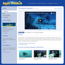
During World War Two, a fierce battle between American and Japanese forces on Kwajalein atoll left a trail of debris on the deep lagoon floor. This lagoon now has one of the largest collections of well-preserved aircraft in the world. In this video, as part of the first ever film crew allowed onto this secret military base, Jonathan explores a B-25, F4-U Corsair and Dauntless dive bomber still sitting on the bottom of the ocean, as if ready to take off. Please see the accompanying study guide for educational objectives and discussion points.

Subject:
Oceanography
Physical Science
Material Type:
Diagram/Illustration
Lesson Plan
Provider:
Jonathan Bird's Blue World
Provider Set:
Jonathan Bird's Blue World
Author:
Jonathan Bird Productions
Oceanic Research Group
Date Added:
03/01/2007
Air-sea Interactions: Activities in Oceanography
Conditional Remix & Share Permitted
CC BY-NC-SA
Rating
0.0 stars

This online set of activities help students learn properties of ocean waves, wind-wave relationships and properties of tsunamis.

(Note: this resource was added to OER Commons as part of a batch upload of over 2,200 records. If you notice an issue with the quality of the metadata, please let us know by using the 'report' button and we will flag it for consideration.)

Subject:
Biology
Geoscience
Life Science
Mathematics
Measurement and Data
Physical Science
Statistics and Probability
Material Type:
Activity/Lab
Assessment
Diagram/Illustration
Provider:
Science Education Resource Center (SERC) at Carleton College
Provider Set:
Teach the Earth
Author:
Steve LaDochy
Date Added:
08/23/2019
Alaska: AK-01 Columbia Glacier Kadin (Narrated)
Read the Fine Print
Rating
0.0 stars

This short, time-lapse video shows the changes in the Columbia Glacier from May 12, 2007 to August 20, 2010. Narration provides general description of the geophysical dynamics and processes.

Subject:
Applied Science
Career and Technical Education
Environmental Science
Environmental Studies
Physical Science
Provider:
CLEAN: Climate Literacy and Energy Awareness Network
Provider Set:
CLEAN: Climate Literacy and Energy Awareness Network
Author:
Extreme Ice Survey
Date Added:
08/17/2018
Alaska Earthquake Hazard Inventory & Mitigation Planning
Conditional Remix & Share Permitted
CC BY-NC-SA
Rating
0.0 stars

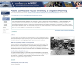
In this two-part activity, students/participants first:
-
Complete a Hazard Inventory for their city or area of interest in the event of a magnitude 7 or larger earthquake and tsunami.
-
Identify what critical structures and infrastructure will be affected.
Then:
-
Write a summary statement assessing strengths and vulnerabilities of essential services or infrastructure.
-
Propose actions for mitigating vulnerabilities.
-
Create an Action Plan to address identified needs.

(Note: this resource was added to OER Commons as part of a batch upload of over 2,200 records. If you notice an issue with the quality of the metadata, please let us know by using the 'report' button and we will flag it for consideration.)
Subject:
Biology
Life Science
Material Type:
Activity/Lab
Provider:
Science Education Resource Center (SERC) at Carleton College
Provider Set:
Teach the Earth
Author:
Bonnie Magura (Portland Public Schools), CEETEP (Cascadia EarthScope Earthquake and Tsunami Education Program), and ANGLE Project
Date Added:
09/26/2022
Alaska GPS Analysis of Plate Tectonics and Earthquakes
Conditional Remix & Share Permitted
CC BY-NC-SA
Rating
0.0 stars

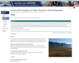
This activity introduces students to high precision GPS as it is used in geoscience research. Students build "gumdrop" GPS units and study data from three Alaska GPS stations from the Plate Boundary Observatory network. They learn how Alaska's south central region is "locked and loading" as the Pacific Plate pushes into North America and builds up energy that will be released in the future in other earthquakes such as the 1964 Alaska earthquake.

(Note: this resource was added to OER Commons as part of a batch upload of over 2,200 records. If you notice an issue with the quality of the metadata, please let us know by using the 'report' button and we will flag it for consideration.)

Subject:
Applied Science
Biology
Engineering
Life Science
Mathematics
Measurement and Data
Statistics and Probability
Material Type:
Activity/Lab
Provider:
Science Education Resource Center (SERC) at Carleton College
Provider Set:
Teach the Earth
Author:
Beth Pratt-Sitaula
Date Added:
09/26/2022
An Alaska Native Community Helps Seals
Read the Fine Print
Educational Use
Rating
0.0 stars

This video from First Alaskans Institute spotlights the Alaska Native community of St. Paul and its hands-on commitment to care for the land and animals on which it depends.

Subject:
Ecology
Forestry and Agriculture
Geoscience
Life Science
Physical Science
Space Science
Material Type:
Lecture
Provider:
PBS LearningMedia
Provider Set:
PBS Learning Media: Multimedia Resources for the Classroom and Professional Development
Author:
National Science Foundation
WGBH Educational Foundation
Date Added:
11/04/2008
Alaska Native Pilots
Read the Fine Print
Educational Use
Rating
0.0 stars

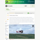
In this video adapted from Storyknife Productions, Alaska Native pilots share how they use traditional knowledge to read the landscape and predict the weather.

Subject:
Applied Science
Ecology
Environmental Science
Forestry and Agriculture
Geoscience
Life Science
Physical Science
Space Science
Material Type:
Lecture
Provider:
PBS LearningMedia
Provider Set:
PBS Learning Media: Multimedia Resources for the Classroom and Professional Development
Author:
National Science Foundation
WGBH Educational Foundation
Date Added:
11/04/2008