
The challenges of Brazil's physical geography.
- Subject:
- Physical Geography
- Physical Science
- Material Type:
- Lecture
- Provider:
- STRATFORvideo
- Date Added:
- 11/23/2016
The challenges of Brazil's physical geography.
Short Description:
This first-year geography textbook takes a holistic approach to geography by incorporating elements of physical, human, and regional geography, as well as bringing in methods and perspectives from spatial information science. This textbook applies a fundamental geographical approach to understanding our globally changing world by looking at local processes, which are linked to larger global processes and events. The textbook includes numerous case studies specific to British Columbia as well as a number of suggested service learning activities.
Long Description:
Over the course of four days in June, 2014, five faculty members from across British Columbia supported by a facilitator, librarian, researcher, illustrator, programmer, and instructional designer created this book. This involved drawing on our own research, teaching, and experience and working with the team to put it all together into an online format; one which would be accessible to students and educators alike.
Beyond the unique way in which this book was created in a book-sprint process, there are other elements of this book that make it unique. First, it takes a holistic approach to first-year geography, incorporating elements of physical, human, and regional geography, as well as bringing in methods and perspectives from spatial information science.
Pedagogically, this book incorporates elements of service learning and suggested service learning activities, recognizing that the study of geography is deeply connected to the communities we live in. Many of the suggestions for service learning are illustrated through the use of case studies from across BC.
The book is aimed at a first-year or introductory geography student and would be suitable for a first-year geography course on BC.
Word Count: 48187
ISBN: 978-1-77420-018-6
(Note: This resource's metadata has been created automatically by reformatting and/or combining the information that the author initially provided as part of a bulk import process.)
This first year Geography textbook takes a holistic approach to Geography by incorporating elements of physical, human and regional geography, as well as bringing in methods and perspectives from spatial information science.. This textbook applies a fundamental geographical approach to understanding our globally changing world by looking at local processes which are linked to larger global processes and events. For example mining and its effects are a global issue and we can see how these unfold in BC. A further example is the recent apology to First Nation peoples on the residential school treatment, as similar events occur in the US, Ireland and Australia. Processes of urbanization, a phenomenon which people all over the globe are experiencing, can be seen in Vancouver with our discussion of the citys development. Geography students, indeed all first year students, need to be able to critically assess their own contexts and environments in order to properly engage with our continually globalizing world.
This lesson highlights the changing relationship between the city center and the suburb in the postwar decades, especially in the 1950s. Students will look at the legislation leading up to and including the Federal Highway Act of 1956. They will also examine documents about the history of Levittown, the most famous and most important of the postwar suburban planned developments.
This Unit is about the geography of Canada.
Compiled and modified for instructional use by: Kate Darby, Western Washington University
In 1887, Robert Towne built a metals smelter two and a half miles northwest of El Paso, Texas, across the river from Ciudad Juarez in Mexico and across the state border from several small towns in New Mexico. The smelter, which processed metal ore from regional mines, was quickly acquired by ASARCO (American Smelting and Refining Company) and became an important visual and economic institution in the region. In 1967, following the mantra of environmental regulation at the time—"the solution to pollution is dilution"—ASARCO erected what was then the tallest smokestack in the world: an 828-foot structure visible from much of the region. While the facility provided jobs to many in the region and produced metals important for a range of manufacturing and consumer products, by the 1970s, residents and scientists began to question the other products from the smelter—especially heavy metals pollution.
This case study includes discussion questions and data sources for further information.
(Note: this resource was added to OER Commons as part of a batch upload of over 2,200 records. If you notice an issue with the quality of the metadata, please let us know by using the 'report' button and we will flag it for consideration.)
Compiled and modified for instructional use by: Lisa Phillips, Illinois State University, llphill@ilstu.edu
On September 10, 2012, several million southern California residents reacted with alarm to an unfamiliar noxious scent. The Air Quality Management District officials in the Los Angeles region were initially at a loss to determine the odor's source. Investigators from Ventura to Palm Springs looked for toxic spills, sewage plant leaks, and gas line breaks—all for naught.
The smell's origin was the Salton Sea more than 150 miles away and not usually upwind. The smell of an algal bloom and subsequent massive fish kill released odor molecules redolent with the stench of environmental decay.
This case study includes discussion questions and data sources for further information.
(Note: this resource was added to OER Commons as part of a batch upload of over 2,200 records. If you notice an issue with the quality of the metadata, please let us know by using the 'report' button and we will flag it for consideration.)
This case study is an examination of the chemical and sensory impacts of a variety of environmental issues including sand mining, leaking underground gasoline storage tanks (LUSTs), and a railroad.
Wedron is a small, unincorporated town of approximately 100 residents in north central Illinois. A large sand mine has been in operation on the south and west sides of the town for many decades, and the mine property includes several abandoned and active pits, a processing plant, and a train car loading facility. Railroad tracks are located along the east side of town as is a grain elevator (storage and loading facility).
The following information was obtained from the US EPA web site about Wedron, personal visits to the town, and published news articles.
This case study includes discussion questions and data sources for further information.
(Note: this resource was added to OER Commons as part of a batch upload of over 2,200 records. If you notice an issue with the quality of the metadata, please let us know by using the 'report' button and we will flag it for consideration.)
This is a 'citizen science' research project where students to apply their knowledge of landslide processes in an investigation of the natural and anthropogenic causes of a real-world landslide catastrophe. Students produce a 'magazine' article discussing the Zhouqu, China, August 8, 2010 landslide catastrophe.
(Note: this resource was added to OER Commons as part of a batch upload of over 2,200 records. If you notice an issue with the quality of the metadata, please let us know by using the 'report' button and we will flag it for consideration.)
Student Atlas of Oregon in English and Spanish
Atlas of Oregon Climate and Climate Change
A behind the scenes interview with Professor Christopher Barnatt, Director and Producer of a new TV documentary on what we perceive to be real, and what, if any, future lies ahead for us.
The TV documentary was televised in April 2009 and was based on a book written by Professor Christopher Barnatt in 1997, also entitled Challenging Reality, which focused on momentus change across history. The new television series developed this theme further, with input from numerous other experts at the University of Nottingham, across three episodes looking at human achievement, geography and communications and the individual and their role in society.
April 2009
Suitable for Undergraduate study and community education
Professor Christopher Barnatt, Associate Professor Business School and Director Producer of "Challenging Reality"
Professor Christopher Barnatt has worked in the Business School at the University of Nottingham for around 19 years, where he is now Director of Teaching. Outside of that role he teaches computing and technology modules, mainly on undergraduate programmes. He is currently researching in the areas of Future Studies, Web 2.0, and green computing, and is actively involved in research, online teaching support and development in a variety of media termed as "Higher Education 2.0".
Outside of the University he is the author of ExplainingComputers.com and ExplainingTheFuture.com, as well as a regular contributor to the Morning Show on BBC Radio Nottingham and "The Night Before" on Kerrang! Radio.
This inquiry leads students through a geographic investigation of the characteristics of a state. During this inquiry, students will utilize an online geographic information system to examine and classify different types of borders. Resource created by Elliot Ruleaux, Yutan Public Schools, as part of the Nebraska ESUCC Social Studies Special Projects 2023 - Inquiry Design Model (IDM).
This article discusses the challenges facing a species of lemur in Madagascar. Due to atypical rain patterns resulting from climate change, the survival rate of the offspring of these lemurs is decreasing. The Climate Kids website is a NASA education resource featuring articles, videos, images and games focused on the science of climate change.
Instructions are provided for constructing a terrarium. The analogy between the terrarium and Earth is also provided. This activity is part of the Climate Kids website, a NASA education resource featuring articles, videos, images and games focused on the science of climate change.
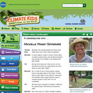
A landscaper explains, through an interview format, how it is possible to design and maintain yards and gardens that require very little water. The Climate Kids website is a NASA education resource featuring articles, videos, images and games focused on the science of climate change.
In this video segment from Nature, scientists work to discover why bees are disappearing.
Open Textbooks for Rural Arizona participants are invited to remix this template to share their courses, textbooks, and other OER material on our Hub.
This article describes common misconceptions about the Arctic and Antarctica and how to test and teach for student understanding.
To address the cost of resources for exercise manuals in GIS, I have developed a series of class exercises that can be used with QGIS, a free and open source software.
In addition, some class activities address more general ideas associated with cartography, such as color theory. To make these resources fully accessible to students, I have recorded publicly available videos documenting how these class activities can be completed. There is one video for each classroom lesson in this course offering, and links to all of the videos on the website Vimeo are linked to.
DESCRIPTION
Develops skills needed to produce maps using ArcGIS Desktop software. Outlines cartographic principles and map use. Emphasis on mapping techniques within a GIS. Intended for students enrolled in GIS or UAS programs.
LEARNING OUTCOMES
1. Demonstrate knowledge and apply skills essential to the discipline.
2. Coordinate and manage the delivery of reliable, valid, GIS data including analysis and specialized user needs products.
3. Communicate effectively and appropriately within a professional setting in both written and oral form.
4. Utilize professional communication skills to achieve project outcomes in collaboration with GIS users across disciplines.
5. Research, interpret and apply data/information in the professional setting.
6. Develop and implement GIS services for users who may or may not be GIS knowledgeable.
The purpose of the resource is to produce a land cover type map from the digital file of a Landsat satellite image using MultiSpec software.