3-D Mapping | Topography By Dana Hoppe, Copyright 2018 by Dana Hoppe …
3-D Mapping | Topography By Dana Hoppe, Copyright 2018 by Dana Hoppe under Creative Commons Non-Commercial License. Individuals and organizations may copy, reproduce, distribute, and perform this work and alter or remix this work for non-commercial purposes only.
Download: 3-D_MappingTopography.pdfDelete
Topography - Design Challenge Introduction - Expanded learning opportunities (ELOs) have the potential to be the great equalizer in American education. Regular participation in high quality before and afterschool learning, and enriching summer school programs have been shown to help low-income students succeed academically on par with their more affluent peers. These programs, characterized by strong school-community partnerships, can also help high-performing students stay engaged and achieve even greater levels of understanding. In short, high-quality ELOs are for everyone - and the benefits they create are critical to Nebraska's future economy. - Beyond School Bells I would like to thank Beyond School Bells as well as Nebraska Innovation Studio for providing me with the opportunity, resources, and encouragement to develop this program as an Innovation Fellow. Their willingness to give the intellectual and creative freedom to build upon my ideas and inspirations is what enabled this program to exist. I strongly believe that opportunities such as the Innovation Fellowship are planting the seeds for Nebraska's future. -Dana Hoppe, Program Creator
Concept and Purpose - Interdisciplinary Learning: This program is focused on developing fundamental STEM skills through interdisciplinary learning. The truth is that all areas of study overlap significantly in one way or another, and the cognitive skills that lead to success in one area surely extend to other areas. A recurring theme I have noticed through my personal experience of being and artist as well as a scientist is that I have heavily utilized my creative thinking abilities to solve challenging problems. Imagination and creativity, when combined with background knowledge and understanding, allow us to find solutions that often lie beyond the rigid structure often associated with mathematics and the sciences. Once we begin to see the overlap between these areas, we begin building bridges between them and new ideas and applications emerge from a formerly empty space. The concept of topography was always interesting to me. The strangeness of being able to discern the shape of the land simply from the distance between a hypnotizing assortment of lines on a flat piece of paper was immediately intriguing. How does this flat sheet of abstract shapes translate to the three-dimensional complexity of a mountain, a valley, or a bluff? Topography is the platform of this program because it is a very versatile concept and can be used to create art and models representing a diverse range of fields. The activities in this program focus on having the students follow processes often found in Computer Science. Every process they complete can be thought of as an algorithm, and when they repeat steps, it can be thought of as a loop. They are also recursively calling the same function on each resulting piece they create, mimicking the concept of dynamic programing. The permutation matrix activities will familiarize students with moving through the data in a matrix and adding data to stacks. While they are doing all of these activities, however, there will be no jargon they have to learn, and they will probably not even realize until they take their first Computer Science course that it is even related. To the students, they will simply be creating art in a new and interesting way.
Biology is designed for multi-semester biology courses for science majors. It is …
Biology is designed for multi-semester biology courses for science majors. It is grounded on an evolutionary basis and includes exciting features that highlight careers in the biological sciences and everyday applications of the concepts at hand. To meet the needs of today’s instructors and students, some content has been strategically condensed while maintaining the overall scope and coverage of traditional texts for this course. Instructors can customize the book, adapting it to the approach that works best in their classroom. Biology also includes an innovative art program that incorporates critical thinking and clicker questions to help students understand—and apply—key concepts.
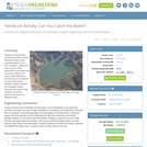
Students construct three-dimensional models of water catchment basins using everyday objects to …
Students construct three-dimensional models of water catchment basins using everyday objects to form hills, mountains, valleys and water sources. They experiment to see where rain travels and collects, and survey water pathways to see how they can be altered by natural and human activities. Students discuss how engineers design structures that impact water collection, as well as systems that clean and distribute water.
Cartography is the art and science of graphically representing a geographical area …
Cartography is the art and science of graphically representing a geographical area on a flat surface such as a map. For Indigenous peoples, cartography is more than just topography or mapping locations. For many Indigenous communities, it's about values, culture and traditional understandings.
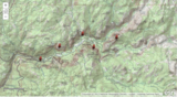
In this example, students learn how to read a topographic map and …
In this example, students learn how to read a topographic map and understand map contours. This resource is from PUMAS - Practical Uses of Math and Science - a collection of brief examples created by scientists and engineers showing how math and science topics taught in K-12 classes have real world applications.
Geology is the core discipline of the earth sciences and encompasses many …
Geology is the core discipline of the earth sciences and encompasses many different phenomena, including plate tectonics and mountain building, volcanoes and earthquakes, and the long-term evolution of Earth’s atmosphere, surface and life. Because of the ever-increasing demand for resources, the growing exposure to natural hazards, and the changing climate, geology is of considerable societal relevance. This course introduces students to the basics of geology. Through a combination of lectures, labs, and field observations, we will address topics ranging from mineral and rock identification to the origin of the continents, from geologic mapping to plate tectonics, and from erosion by rivers and glaciers to the history of life.
This is an activity about spacecraft design. Teams of learners will model …
This is an activity about spacecraft design. Teams of learners will model how scientists and engineers design and build spacecraft to collect, store, and transmit data to earth. Teams will design a system to store and transmit topographic data of the Moon and then analyze that data and compare it to data collected by the Lunar Reconnaissance Orbiter .
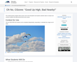
This module teaches students about ozone’s role in the atmosphere and explores …
This module teaches students about ozone’s role in the atmosphere and explores authentic data to compare and contrast conditions that affect ground-level ozone values.
This course introduces the structure, composition, and physical processes governing the terrestrial …
This course introduces the structure, composition, and physical processes governing the terrestrial planets, including their formation and basic orbital properties. Topics include plate tectonics, earthquakes, seismic waves, rheology, impact cratering, gravity and magnetic fields, heat flux, thermal structure, mantle convection, deep interiors, planetary magnetism, and core dynamics. Suitable for majors and non-majors seeking general background in geophysics and planetary structure.
"This course introduces the structure, composition, and physical processes governing the terrestrial …
"This course introduces the structure, composition, and physical processes governing the terrestrial planets, including their formation and basic orbital properties. Topics include plate tectonics, earthquakes, seismic waves, rheology, impact cratering, gravity and magnetic fields, heat flux, thermal structure, mantle convection, deep interiors, planetary magnetism, and core dynamics. Suitable for majors and non-majors seeking general background in geophysics and planetary structure."
This course is a client-based land analysis and site planning project. The …
This course is a client-based land analysis and site planning project. The primary focus of the course changes from year to year. This year the focus is on Japan's New Towns. Students will review land inventory, analysis, and planning of sites and the infrastructure systems that serve them. They will also examine spatial organization of uses, parcelization, design of roadways, grading, utility systems, stormwater runoff, parking, traffic and off-site impacts, as well as landscaping. Lectures will cover analytical techniques and examples of good site-planning practice. Requirements include a series of assignments and a client-based project.
Students analyze and begin to design a pyramid. Working in engineering teams, …
Students analyze and begin to design a pyramid. Working in engineering teams, they perform calculations to determine the area of the pyramid base, stone block volumes, and the number of blocks required for their pyramid base. They make a scaled drawing of the pyramid using graph paper.
These exercises are designed to guide a student to an understanding of …
These exercises are designed to guide a student to an understanding of how rainfall and storm events result in runoff over the surface of the earth. Runoff is influenced by the nature of the surface of the earth. Streamflow is particularly influenced by urbanization-the paving over of permeable surfaces with impermeable ones. In light of this, students are encouraged to think about design elements that incorporate more permeable surfaces into their own environments, including their school parking lots and neighborhoods.
Interpret properties of the landscape using topographic maps of well-known national parks. …
Interpret properties of the landscape using topographic maps of well-known national parks. Direct link on ArcGIs. THE EARTH SCIENCE GEOINQUIRY COLLECTIONhttp://www.esri.com/geoinquiriesThe Earth Science GeoInquiry collection contains 15 free, web-mapping activities that correspond and extend map-based concepts in leading middle school Earth science textbooks. The activities use a standard inquiry-based instructional model, require only 15 minutes for a teacher to deliver, and are device agnostic. The activities harmonize with the Next Generation Science Standards. Activity topics include:• Topographic maps• Remote sensing• Minerals / Mining• Rock Types• Landforms• Plate tectonics• Earthquakes• Volcanoes• Mountain building• Fresh water• Ocean features• Ground wind and temperature patterns• Weather• Storms• Climate change
No restrictions on your remixing, redistributing, or making derivative works. Give credit to the author, as required.
Your remixing, redistributing, or making derivatives works comes with some restrictions, including how it is shared.
Your redistributing comes with some restrictions. Do not remix or make derivative works.
Most restrictive license type. Prohibits most uses, sharing, and any changes.
Copyrighted materials, available under Fair Use and the TEACH Act for US-based educators, or other custom arrangements. Go to the resource provider to see their individual restrictions.