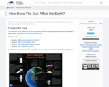
This video segment adapted from NOVA features the youngest rock formations in …
This video segment adapted from NOVA features the youngest rock formations in the Grand Canyon, lava dams, and how they are subject to the eroding power of water.
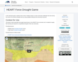
In this interactive game, students work in three "resilience teams" to solve …
In this interactive game, students work in three "resilience teams" to solve community challenges that arise during the course of an extreme drought event by using available individual and community resources.
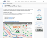
This interactive game has students work in three “zone response teams” to …
This interactive game has students work in three “zone response teams” to solve community challenges that arise during the course of an extreme flooding event by using available individual and community resources.
This course introduces students to modern world history and geography. It provides …
This course introduces students to modern world history and geography. It provides an opportunity for students to learn and further develop foundational research and writing skills by incorporating practice into every class session. Early in the course, students select a country to study, then all research and writing activities are focused on that country. It also utilizes the United Nations Sustainable Development Goals to help students explore their country.The course utilizes openly licensed textbooks and publicly available materials as course materials.This survey course is intended for freshmen and sophomore-level students who are interested in exploring historical, political and social contexts beyond their own. Students will have ample opportunities to practice foundational skills including writing, research, source citation, critical thinking and public speaking.It was originally taught over 13 weeks as part of a Fulbright US Scholar grant in the International College at Tunghai University in Taichung Taiwan. It was developed with support from the Open Education for a Better World Program.
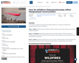
SYNOPSIS: In this lesson, students will examine the 2020 Almeda Fire in …
SYNOPSIS: In this lesson, students will examine the 2020 Almeda Fire in Oregon and explore the disproportionate impacts of wildfires.
SCIENTIST NOTES: This engaging lesson helps students comprehend what wildfires are, the climatic factors that could start them and speed up their spread, and the potential losses and harm that they could do to vulnerable and marginalized populations. The wildfire simulator has been evaluated and is suitable for use by students. Additionally, the lesson's videos and other supporting resources have been examined, and this lesson has passed our science credibility process.
POSITIVES: -This lesson clearly explains the connection between climate change and wildfires. -This lesson allows students to realize how wildfires disproportionately impact different groups of people. It provides space for students to better understand the concept of climate justice.
ADDITIONAL PREREQUISITES: -Be sensitive to the needs of your students if they have been personally impacted by wildfire. Depending on the circumstances, this lesson may not be appropriate or may need to be adapted for your class. -This lesson assumes that students have prerequisite knowledge of climate change, including understanding the basic science behind climate change. -Each student will need access to a device in order to play with the Wildfire Simulation. If each student does not have a device, students may share devices. If there are no devices for students, teacher can project and play with the Wildfire Simulation on an interactive whiteboard.
DIFFERENTIATION: -Pay close attention to how student groups are formed in the jigsaw activity during the Investigate section. Students will be jointly constructing meaning from reading different parts of the article. Groups of students with varying reading levels will probably work best, as high-achieving peers can model meaning-making for students at lower reading levels. -It may be best to steer students toward one or more options in the menu in the Inquire section, depending on their ability and preference for demonstrating their knowledge. -In the Inquire section, it may not be possible for any or all of your students to create a wildfire emergency supply kit. Gathering and paying for all of those items is expensive. Be sensitive to your students. In some cases, it may be best to remove that option from the menu before sharing it with your students.
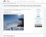
This lesson has students explore how the gases trapped in ice cores …
This lesson has students explore how the gases trapped in ice cores over the last quarter of a century can be used to understand how Earth's atmosphere has changed in the past.
The Indian Ocean Basin is becoming an important topic in middle and …
The Indian Ocean Basin is becoming an important topic in middle and high school world history and geography courses, but one for which there are few instructional resources. This web-based resource helps teachers incorporate the Indian Ocean into world history studies by illustrating a variety of interactions that took place in the Indian Ocean during each era. The material is assembled into an integrated and user-friendly teaching tool for students in upper elementary, middle and high school. It offers students the chance to investigate primary sources that illustrate historical interactions, helping them to become more adept at the analytical historical thinking skills that are required by virtually all state history standards today.
The purpose of the resource is to investigate changes in the major …
The purpose of the resource is to investigate changes in the major land cover types of Study Sites by examining Landsat satellite images acquired years apart.
The Adirondack Mountains tour is part of the New York Landscape Regions …
The Adirondack Mountains tour is part of the New York Landscape Regions Collection of Google Earth Tours, created by a group of New York State science educators. This tour provides an introduction to the geology of the Great Range and the High Peaks as viewed from Algonquin Peak. It also addresses the issue of acid rain, which is a persistent environmental concern in the Adirondacks.
The Allegheny Plateau tours are part of the New York Landscape Regions …
The Allegheny Plateau tours are part of the New York Landscape Regions Collection of Google Earth Tours, created by a group of New York State science educators. These tours showcase examples of Allegheny geology, including the geomorphology of glacial features near Tully, New York, southern Cayuga Lake, the geology and geomorphology of Letchworth State Park and its waterfalls, as well as waterfalls and creeks in the Ithaca Gorges. Schoharie Creek can be toured from its mouth to its source, the St. Lawrence Chesapeake and Valley Heads Moraine can be investigated to examine drainage patterns, and another tour investigates the unique geology and ecology of the Rome Sand Plains. Environmental tours also address the 2006 flooding in the Allegheny Plateau near Port Jarvis and Livingston Manor and provide an overview of the water supply system of the City of New York.
The Atlantic Coastal Plain tour is part of the New York Landscape …
The Atlantic Coastal Plain tour is part of the New York Landscape Regions Collection of Google Earth Tours, created by a group of New York State science educators. This tour introduces students to glacial erratics on Long Island, the Ronkonkoma terminal moraine, and the Rock Hill erratic. Coastal erosion and deposition can be studied by viewing dunes, beaches, and wave cut banks.
The Erie Ontario Lowlands tour is part of the New York Landscape …
The Erie Ontario Lowlands tour is part of the New York Landscape Regions Collection of Google Earth tours. This tour includes glacial history, features, and views of Niagara Falls, the Niagara Escarpment, current and former spillways, and the locks at Lockport, New York. Students can also learn about the geology and glacial history of Canandaigua Lake, one of New York's Finger Lakes, which discharges into the Lowlands. There is also a lab activity in which students analyze maps, images, and information to perform an environmental assessment of the Cascade Mill development.
The Hudson Highlands tour is part of the New York Landscape Regions …
The Hudson Highlands tour is part of the New York Landscape Regions Collection of Google Earth Tours, created by a group of New York State science educators. This tour introduces Hudson Highlands geology, including glaciology at Bear Mountain, views of the Highlands, and the Ramapo Fault to the south. It also offers other information about the area, including some animals, New York City's water supply, and the Great Swamp.
The Hudson Mohawk Lowlands tour is part of the New York Landscape …
The Hudson Mohawk Lowlands tour is part of the New York Landscape Regions Collection of Google Earth tours, created by a group of New York State science educators. This tour introduces students to limestone quarrying along the western shore of the Hudson River south of Catskill, New York. They can follow the courses of the Mohawk River and Erie Canal eastward to the Cohoes Falls and the confluence of the Mohawk with the Hudson River. It also provides a look at issues involved with the cleanup of PCB-laden sediments in the Hudson River.
The Newark Lowlands tour is part of the New York Landscape Regions …
The Newark Lowlands tour is part of the New York Landscape Regions Collection of Google Earth Tours created by a group of New York State science educators. This tour lets students see the Ramapo Fault at the Lowlands' northwestern boundary and the Palisades Sill on the western shore of the Hudson River. The Sparkill Gap, a pre-Ice Age weak spot in the Palisades Sill through which the Hudson River once flowed, can be observed. There is also an activity in which students explore the economic, social, and environmental issues associated with constructing the Tappan Zee Bridge over the Hudson River.
The St. Lawrence Lowlands tour is part of the New York Landscape …
The St. Lawrence Lowlands tour is part of the New York Landscape Regions Collection of Google Earth Tours. This tour allows students to explore the Thousand Islands, formed of granite which has withstood the erosive energy of the St. Lawrence River, creating thousands of islands ranging in size from single rocks to over 25 square miles. There is also an activity in which students map some of the many shipwrecks that have accumulated at the entrance to the St. Lawrence Seaway.
No restrictions on your remixing, redistributing, or making derivative works. Give credit to the author, as required.
Your remixing, redistributing, or making derivatives works comes with some restrictions, including how it is shared.
Your redistributing comes with some restrictions. Do not remix or make derivative works.
Most restrictive license type. Prohibits most uses, sharing, and any changes.
Copyrighted materials, available under Fair Use and the TEACH Act for US-based educators, or other custom arrangements. Go to the resource provider to see their individual restrictions.