These educational videos provide an invaluable resource on Ancient Nubia for Middle …
These educational videos provide an invaluable resource on Ancient Nubia for Middle and High School Ancient World History and Geography teachers and students. The video content aligns with Geography, Economics, Civics, and Historical Thinking Social Studies standards across the nation. Key concepts and inquiry skills from each content area weave seamlessly throughout the videos and associated lesson plans. This unit overview document links to developed resources on the Archeology in the Community site.
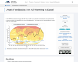
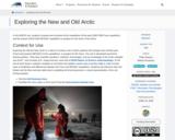
In this middle school and high school unit, students engage with 360° …
In this middle school and high school unit, students engage with 360° virtual reality tours, authentic Arctic datasets, and app-based labs to construct models and explanations for the unit driving question, "Why might the Arctic be warming twice as fast as the rest of the world?"
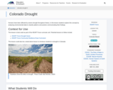
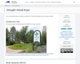
Humans have been affected by severe drought throughout history; in this lesson …
Humans have been affected by severe drought throughout history; in this lesson students explore this concept by analyzing environmental data to classify patterns and practice communicating their findings.
In this activity, students construct three-dimensional models from terrain information provided by …
In this activity, students construct three-dimensional models from terrain information provided by two-dimensional topographic maps. This will allow them to visualize how changes in elevation over a certain distance can be represented on a flat piece of paper that can be folded up and tucked away. Each group is responsible for constructing a model of Mount St. Helens 'before' and 'after', a depression, a stream, and a hill. Discussion questions related to the different representations are also included.
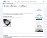
In this lesson, students create a compass and apply their reasoning about …
In this lesson, students create a compass and apply their reasoning about magnetism to how compasses work to help us navigate around the globe while utilizing the Earth’s magnetic field.
This lesson provides experience working on a real-life scenario by allowing students …
This lesson provides experience working on a real-life scenario by allowing students the opportunity to use topographic maps to design a hiking trail system based on access from road, range of habitats, and other specified criteria. They will also complete a data sheet and produce an informational brochure.
A learning activity for the "Do You Know That Clouds Have Names?" …
A learning activity for the "Do You Know That Clouds Have Names?" book in the Elementary GLOBE series. Using information from the book and their observations, students construct a sky scene with trees and buildings as reference points on the ground and cloud types ordered by altitude in the sky. Students will describe clouds using their own vocabulary and will then correlate their descriptions with the standard classifications of cloud types used by the GLOBE Program. The purpose of the activity is to help students identify some of the characteristics of clouds and to enable students to observe clouds, describe them in a common vocabulary, and compare their descriptions with the official cloud names. Students will be able to identify cloud types using standard cloud classification names. They will know that the names used for the clouds are based on three factors: their shapes, the altitude at which they occur, and whether they are producing precipitation.
A learning activity for the "Do You Know That Clouds Have Names?" …
A learning activity for the "Do You Know That Clouds Have Names?" book in the Elementary GLOBE series. Students will explore the difference between the three types of contrails, make observations of contrails outside, and record their observations. Fifteen minutes later they will make follow-up observations to see how the contrails they observed have changed. The purpose of the activity is to help students identify contrails and learn to distinguish between the three types of contrails and to understand that contrails are human-made and some contrails become clouds in the sky. Students will be able to (1) identify the three types of contrails; (2) understand that contrails are created by jet airplanes; and (3) understand that some contrails become clouds.
In this middle school and high school unit, students compare and constrast …
In this middle school and high school unit, students compare and constrast Arctic expeditions of the past (1893-1896 Fram expedition) and the present (2019-2020 MOSAiC expedition) to prepare for the Arctic of the future.
PhysicalGeography.net is an educational web portal that focuses on a specific area …
PhysicalGeography.net is an educational web portal that focuses on a specific area knowledge known as Physical Geography. Physical Geography is a sub-discipline of two much larger fields of study - Geography and Earth Sciences.
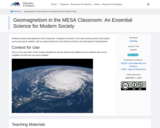
Students explore geomagnetism with compasses, navigation exercises, and a geo-caching activity and …
Students explore geomagnetism with compasses, navigation exercises, and a geo-caching activity and explore aurora and space weather, with an optional field trip to the National Oceanic and Atmospheric Administration.
No restrictions on your remixing, redistributing, or making derivative works. Give credit to the author, as required.
Your remixing, redistributing, or making derivatives works comes with some restrictions, including how it is shared.
Your redistributing comes with some restrictions. Do not remix or make derivative works.
Most restrictive license type. Prohibits most uses, sharing, and any changes.
Copyrighted materials, available under Fair Use and the TEACH Act for US-based educators, or other custom arrangements. Go to the resource provider to see their individual restrictions.