During Activity 2.2, students download, organize, and analyze geoscience data sets of …
During Activity 2.2, students download, organize, and analyze geoscience data sets of sea level trends, terrestrial ice sheet trends, and intensity of tropical cyclones as well as forecast models of atmospheric CO2 and temperature trends and sea level rise. Students utilize the methods of geoscience such as systems thinking and using multiple lines of evidence to determine possible relationships and feedbacks among the data sets. Students use this data to construct their argument from evidence for a position paper in Activity 2.3.
(Note: this resource was added to OER Commons as part of a batch upload of over 2,200 records. If you notice an issue with the quality of the metadata, please let us know by using the 'report' button and we will flag it for consideration.)
In Activity 2.3, students make an argument from evidence to address the …
In Activity 2.3, students make an argument from evidence to address the problem: "To what extent should we build or rebuild coastal communities?" Students work as a team to complete a graphic organizer. This task helps them organize an evidence-based position paper. Each student writes his or her own position paper.
(Note: this resource was added to OER Commons as part of a batch upload of over 2,200 records. If you notice an issue with the quality of the metadata, please let us know by using the 'report' button and we will flag it for consideration.)
In this two-part activity, students/participants first: - Complete a Hazard Inventory for …
In this two-part activity, students/participants first: - Complete a Hazard Inventory for their city or area of interest in the event of a magnitude 7 or larger earthquake and tsunami. - Identify what critical structures and infrastructure will be affected. Then: - Write a summary statement assessing strengths and vulnerabilities of essential services or infrastructure. - Propose actions for mitigating vulnerabilities. - Create an Action Plan to address identified needs.
(Note: this resource was added to OER Commons as part of a batch upload of over 2,200 records. If you notice an issue with the quality of the metadata, please let us know by using the 'report' button and we will flag it for consideration.)
This activity introduces students to high precision GPS as it is used …
This activity introduces students to high precision GPS as it is used in geoscience research. Students build "gumdrop" GPS units and study data from three Alaska GPS stations from the Plate Boundary Observatory network. They learn how Alaska's south central region is "locked and loading" as the Pacific Plate pushes into North America and builds up energy that will be released in the future in other earthquakes such as the 1964 Alaska earthquake.
(Note: this resource was added to OER Commons as part of a batch upload of over 2,200 records. If you notice an issue with the quality of the metadata, please let us know by using the 'report' button and we will flag it for consideration.)
The impact of natural disasters is made vivid in this video segment …
The impact of natural disasters is made vivid in this video segment adapted from NOVA. A small town in Iceland, prepared for recurrent avalanches, is devastated when one takes a new and damaging path.
This document includes two activities related to earthquake base isolation. Learners explore …
This document includes two activities related to earthquake base isolation. Learners explore earthquake hazards and damage to buildings by constructing model buildings and subjecting the buildings to ground vibration (shaking similar to earthquake vibrations) on a small shake table. Base isolation a powerful tool for earthquake engineering. It is meant to enable a building to survive a potentially devastating seismic impact through a proper initial design or subsequent modifications. The buildings are constructed by two- or three-person learner teams.
(Note: this resource was added to OER Commons as part of a batch upload of over 2,200 records. If you notice an issue with the quality of the metadata, please let us know by using the 'report' button and we will flag it for consideration.)
Building Oscillation Seismic Simulation, or BOSS, is an opportunity for learners to …
Building Oscillation Seismic Simulation, or BOSS, is an opportunity for learners to explore the phenomenon of resonance for different building heights while performing a scientific experiment that employs mathematical skills. They experience how structures behave dynamically during an earthquake.
(Note: this resource was added to OER Commons as part of a batch upload of over 2,200 records. If you notice an issue with the quality of the metadata, please let us know by using the 'report' button and we will flag it for consideration.)
IRIS (Incorporated Research Institutions for Seismology), FEMA (Federal Emergency Management Administration), ShakeAlert, Chris Hedeen (Oregon City High School), and ANGLE Project
In this video segment adapted from NOVA, scientists are on the hunt …
In this video segment adapted from NOVA, scientists are on the hunt for tornadoes. Using Doppler radar, they gather data in the hopes of solving the mystery of how tornadoes form.
In this activity students synthesize ideas from lecture, reading, and viewing two …
In this activity students synthesize ideas from lecture, reading, and viewing two PBS NOVA videos on hurricanes.
(Note: this resource was added to OER Commons as part of a batch upload of over 2,200 records. If you notice an issue with the quality of the metadata, please let us know by using the 'report' button and we will flag it for consideration.)
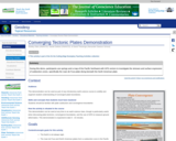
During this demo, participants use springs and a map of the Pacific …
During this demo, participants use springs and a map of the Pacific Northwest with GPS vectors to investigate the stresses and surface expression of subduction zones, specifically the Juan de Fuca plate diving beneath the North American plate.
(Note: this resource was added to OER Commons as part of a batch upload of over 2,200 records. If you notice an issue with the quality of the metadata, please let us know by using the 'report' button and we will flag it for consideration.)
Student groups create blogs or VoiceThreads on selected natural disaster events including …
Student groups create blogs or VoiceThreads on selected natural disaster events including a description of the event, the cause of the disaster, response & recovery, prediction & prevention and resilience to the event.
(Note: this resource was added to OER Commons as part of a batch upload of over 2,200 records. If you notice an issue with the quality of the metadata, please let us know by using the 'report' button and we will flag it for consideration.)
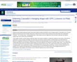
Research-grade Global Positioning Systems (GPS) allow students to deduce that Earth's crust …
Research-grade Global Positioning Systems (GPS) allow students to deduce that Earth's crust is changing shape in measurable ways. From data gathered by EarthScope's Plate Boundary Observatory, students discover that the Pacific Northwest of the United States and coastal British Columbia -- the Cascadia region - are geologically active: tectonic plates move and collide; they shift and buckle; continental crust deforms; regions warp; rocks crumple, bend, and will break.
(Note: this resource was added to OER Commons as part of a batch upload of over 2,200 records. If you notice an issue with the quality of the metadata, please let us know by using the 'report' button and we will flag it for consideration.)
As a culminating assignment in Natural Hazards Planning, students work in teams …
As a culminating assignment in Natural Hazards Planning, students work in teams to create 15-year mitigation strategy for a selected jurisdiction using the FEMA 386 methodology for prioritizing mitigation options.
(Note: this resource was added to OER Commons as part of a batch upload of over 2,200 records. If you notice an issue with the quality of the metadata, please let us know by using the 'report' button and we will flag it for consideration.)
In this guided research and critical thinking activity, students prepare a research …
In this guided research and critical thinking activity, students prepare a research paper comprised of two parts: 1) a "state-of-the-science" review and synthesis of selected literature from risk and resilience research (provided) and 2) a brief critical appraisal of how current knowledge is (or could be) applied to building disaster resilience in a real-world scenario. Part 2 will be set in a student-selected hazard context (coastal hazards, flooding, or earthquake), employment sector (academia, government, private industry, services, non-profit), and geopolitical sphere of influence (e.g., Resilience to earthquake disaster in the student population at Universidad de Lima, Peru).
(Note: this resource was added to OER Commons as part of a batch upload of over 2,200 records. If you notice an issue with the quality of the metadata, please let us know by using the 'report' button and we will flag it for consideration.)
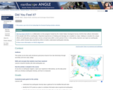
Did you have an earthquake where you live and want to participate …
Did you have an earthquake where you live and want to participate in Community Science? Would you like students to better understand how earthquake intensity is determined? This guide provides ideas about how you can incorporate the online USGS tool: Did You Feel It? into your classroom.
(Note: this resource was added to OER Commons as part of a batch upload of over 2,200 records. If you notice an issue with the quality of the metadata, please let us know by using the 'report' button and we will flag it for consideration.)
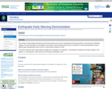
This hands-on demonstration illustrates how GPS instruments can be used in earthquake …
This hands-on demonstration illustrates how GPS instruments can be used in earthquake early warning systems to alert people of impending shaking. The same principles can be applied to other types of early warning systems (such as tsunami) or to early warning systems using a different type of geophysical sensor (such as a seismometer instead of a GPS).This demo is essentially a game that works best with a large audience (ideally over 30 people) in an auditorium. A few people are selected to be either surgeons, GPS stations, or a warning siren, with everyone else forming an earthquake "wave."
(Note: this resource was added to OER Commons as part of a batch upload of over 2,200 records. If you notice an issue with the quality of the metadata, please let us know by using the 'report' button and we will flag it for consideration.)
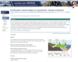
Ground shaking is the primary cause of earthquake damage to man-made structures. …
Ground shaking is the primary cause of earthquake damage to man-made structures. This exercise combines three related activities on the topic of shaking-induced ground instability: a ground shaking amplification demonstration, a seismic landslides demonstration, and a liquefaction experiment. The amplitude of ground shaking is affected by the type of near-surface rocks and soil. Earthquake ground shaking can cause even gently sloping areas to slide when those same areas would be stable under normal conditions. Liquefaction is a phenomenon where water-saturated sand and silt take on the characteristics of a dense liquid during the intense ground shaking of an earthquake and deform. Includes Alaska and San Francisco examples.
(Note: this resource was added to OER Commons as part of a batch upload of over 2,200 records. If you notice an issue with the quality of the metadata, please let us know by using the 'report' button and we will flag it for consideration.)
Introductory lesson that compares ShakeMaps between earthquakes in the same location but …
Introductory lesson that compares ShakeMaps between earthquakes in the same location but different magnitudes, and earthquakes of the same magnitude but different depths, to acquaint learners to the fundamental controls on intensity of shaking felt during an event: magnitude and distance from the earthquake source.
(Note: this resource was added to OER Commons as part of a batch upload of over 2,200 records. If you notice an issue with the quality of the metadata, please let us know by using the 'report' button and we will flag it for consideration.)
This video segment adapted from NOVA tells the tragic story of two …
This video segment adapted from NOVA tells the tragic story of two Japanese seismologists who disagreed about the threat of earthquakes in the early twentieth century. Today, seismologists in California offer residents a probability of risk that an earthquake might occur.
This lesson on earthquakes is based on naturalist John Muir's experiences with …
This lesson on earthquakes is based on naturalist John Muir's experiences with two significant earthquakes, the 1872 earthquake on the east side of the Sierra Nevada Mountains, and the Great San Francisco Earthquake of 1906. Students will learn to explain that earthquakes are sudden motions along breaks in the crust called faults, and list the major geologic events including earthquakes, volcanic eruptions and mountain building, which are the result of crustal plate motions. A downloadable, printable version (PDF) of the lesson plan is available.
No restrictions on your remixing, redistributing, or making derivative works. Give credit to the author, as required.
Your remixing, redistributing, or making derivatives works comes with some restrictions, including how it is shared.
Your redistributing comes with some restrictions. Do not remix or make derivative works.
Most restrictive license type. Prohibits most uses, sharing, and any changes.
Copyrighted materials, available under Fair Use and the TEACH Act for US-based educators, or other custom arrangements. Go to the resource provider to see their individual restrictions.