Acting as engineering teams, students take measurements and make calculations to determine …
Acting as engineering teams, students take measurements and make calculations to determine the specific strength of various alloys and then report their data to the rest of the class. Using this class data, students write data-based recommendations to NASA regarding the best alloy to use in the construction of the engine and engine turbines for the Space Launch System that will eventually be used to transport astronauts to Mars.
The year is 2032 and your class has successfully achieved a manned …
The year is 2032 and your class has successfully achieved a manned mission to Mars! After several explorations of the Red Planet, one question is still being debated: "Is there life on Mars?" The class is challenged with the task of establishing criteria to help look for signs of life. Student explorers conduct a scientific experiment in which they evaluate three "Martian" soil samples and determine if any contain life.
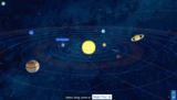
Overview: Blue Coral Guide to the Solar System is an interactive 3D …
Overview: Blue Coral Guide to the Solar System is an interactive 3D model of the solar system. Freely browse by selecting, dragging, and zooming or step through the grand tour. Each stop along the way contains an optional profile for more detail.
Included in the model is the sun, all 8 planets, Earth's moon, 3 dwarf planets, the asteroid belt, the kuiper belt, the oort cloud, and Haley's comet.
Blue Coral Guide to the Solar System is fully responsive in the web browser for large and small devices in both horizontal and vertical orientations.
This math example explains what celestial objects a person can see with …
This math example explains what celestial objects a person can see with the unaided eye from the vantage points of Earth and Mars, using simple math, algebra and astronomical distance information. This resource is from PUMAS - Practical Uses of Math and Science - a collection of brief examples created by scientists and engineers showing how math and science topics taught in K-12 classes have real world applications.
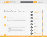
Using planetary maps, students will be able to read cartographic information and …
Using planetary maps, students will be able to read cartographic information and compare the environmental conditions of Mars to those Earth. They will understand the conditions needed for life to exist, and be able to explain why it cannot exist on Mars.
Have you ever wondered why it takes such a long period of …
Have you ever wondered why it takes such a long period of time for NASA to build space exploration equipment? What is involved in manufacturing and building a rover for the Red Planet? During this lesson, students will discover the journey that a Mars rover embarks upon after being designed by engineers and before being prepared for launch. Students will investigate the fabrication techniques, tolerance concepts, assembly and field-testing associated with a Mars exploratory rover.
Prior to this lab exercise, students discuss general physical differences between the …
Prior to this lab exercise, students discuss general physical differences between the planets Earth, Moon and Mars, and why these physical differences exist. They use globes and global data sets in lecture to investigate large-scale patters, similarities and differences between these bodies. They discuss methods by which planetary geologists study the surfaces of other planets. While working on this laboratory exercise, they use maps of the Earth, Moon and Mars (both geologic and topographic) as well as data from missions such as Clementine, MOLA, and HRSC, which they obtain online. The investigate impact crater morphology between the Earth and Moon; comparative planetary geology in the form of fluvial, tectonic, and volcanologic comparisons of Earth and Mars; and complete a geologic map and history of a region of Mars using only orbital images and data sets.
(Note: this resource was added to OER Commons as part of a batch upload of over 2,200 records. If you notice an issue with the quality of the metadata, please let us know by using the 'report' button and we will flag it for consideration.)
This is an activity about creating impacts on sandy surfaces. Learners will …
This is an activity about creating impacts on sandy surfaces. Learners will use trays of sand and a variety of solid objects to model the effects of "impactors" on the surface. This is activity 6 of 9 in Mars and Earth: Science Learning Activities for After School.
Learners will use trays of sand and cups of water to recreate …
Learners will use trays of sand and cups of water to recreate surface features seen in images of Mars. This is activity 5 of 9 in Mars and Earth: Science Learning Activities for After School.
This is an activity about modeling the effect of wind on a …
This is an activity about modeling the effect of wind on a sandy surface. Learners will use trays of sand and straws to recreate surface features of images of Mars. Participants test their ideas about how some of the features on Mars might have been produced. This is activity 4 of 9 in Mars and Earth: Science Learning Activities for After School.
In the latest episode of #EZScience, learn about the upcoming launch of …
In the latest episode of #EZScience, learn about the upcoming launch of Perseverance. Dr. E and Dr. Z talk about the technological advancements of the newest Mars rover (and helicopter!).
In this "On the Go" episode of #EZScience, we're on the scene …
In this "On the Go" episode of #EZScience, we're on the scene at Kennedy Space Center with the rocket that will take the Perseverance rover and the Ingenuity helicopter to Mars.
Watch the fourth episode of our #EZScience series to learn about NASA's …
Watch the fourth episode of our #EZScience series to learn about NASA's upcoming Mars 2020 rover mission by looking back at the Mars Pathfinder mission and Sojourner rover.
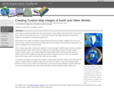
DATA: Planetary images and geodesy data. TOOL: UNAVCO's Jules Verne Voyager Map Server. SUMMARY: Generate maps of Earth or any of 19 other planets and moons. Save and import images into presentations or reports.
(Note: this resource was added to OER Commons as part of a batch upload of over 2,200 records. If you notice an issue with the quality of the metadata, please let us know by using the 'report' button and we will flag it for consideration.)
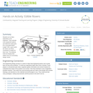
Students act as Mars exploratory rover engineers. They evaluate rover equipment options …
Students act as Mars exploratory rover engineers. They evaluate rover equipment options and determine what parts fit in a provided NASA budget. With a given parts list, teams use these constraints to design for their rover. The students build and display their edible rover at a concluding design review.
The purpose of this activity is to recreate the classic egg-drop experiment …
The purpose of this activity is to recreate the classic egg-drop experiment with an analogy to the Mars rover landing. The concept of terminal velocity will be introduced, and students will perform several velocity calculations. Also, students will have to design and build their lander within a pre-determined budget to help reinforce a real-world design scenario.
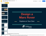
This lesson presents characteristics of spacecraft models on mars to see how …
This lesson presents characteristics of spacecraft models on mars to see how well they meet design requirements and then presents a design challenge for students.
No restrictions on your remixing, redistributing, or making derivative works. Give credit to the author, as required.
Your remixing, redistributing, or making derivatives works comes with some restrictions, including how it is shared.
Your redistributing comes with some restrictions. Do not remix or make derivative works.
Most restrictive license type. Prohibits most uses, sharing, and any changes.
Copyrighted materials, available under Fair Use and the TEACH Act for US-based educators, or other custom arrangements. Go to the resource provider to see their individual restrictions.