This studio explores the notion of in-between by engaging several relationships; the …
This studio explores the notion of in-between by engaging several relationships; the relationship between intervention and perception, between representation and notation and between the fixed and the temporal. In the Exactitude in Science, Jorge Luis Borges tells the perverse tale of the one to one scale map, where the desire for precision and power leads to the escalating production of larger and more accurate maps of the territory. For Jean Baudrillard, "The territory no longer precedes the map nor survives it. …it is the map that precedes the territory... and thus, it would be the territory whose shreds are slowly rotting across the map." The map or the territory, left to ruin-shredding across the 'other', beautifully captures the tension between reality and representation. Mediating between collective desire and territorial surface, maps filter, create, frame, scale, orient, and project. A map has agency. It is not merely representational but operational, the experience and discursive potential of this process lies in the reciprocity between the representation and the real. It is in-between these specific sets of relationships that this studio positions itself.
4.125 is the third undergraduate design studio. This subject introduces skills needed …
4.125 is the third undergraduate design studio. This subject introduces skills needed to build within a landscape establishing continuities between the built and natural world. Students learn to build appropriately through analysis of landscape and climate for a chosen site, and to conceptualize design decisions through drawings and models.
Students construct three-dimensional models of water catchment basins using everyday objects to …
Students construct three-dimensional models of water catchment basins using everyday objects to form hills, mountains, valleys and water sources. They experiment to see where rain travels and collects, and survey water pathways to see how they can be altered by natural and human activities. Students discuss how engineers design structures that impact water collection, as well as systems that clean and distribute water.
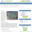
Students consider the Earth's major types of landforms such as mountains, rivers, …
Students consider the Earth's major types of landforms such as mountains, rivers, plains, hills, canyons, oceans and plateaus. Student teams build three-dimensional models of landscapes, depicting several of these landforms. Once the models are built, they act as civil and transportation engineers to design and build roads through the landscapes they have created. The worksheet is provided in English and Spanish.
GEOG 571 explores the relationships between culture and civil security and the …
GEOG 571 explores the relationships between culture and civil security and the process of geographically analyzing social, political, economic, and demographic information to understand human history, institutions, and behaviors. It is an elective course in the Geospatial Intelligence Certificate, the Intercollege Master of Professional Studies (iMPS-HLS), and the Master of Geographic Information Systems degree program that is offered exclusively through Penn State's World Campus. It is also one of the optional capstone courses that leads to Penn State's Postbaccalaureate Certificate in GIS. The course consists of projects, associated readings, and exams.
Students are briefly introduced to Maxwell's equations and their significance to phenomena …
Students are briefly introduced to Maxwell's equations and their significance to phenomena associated with electricity and magnetism. Basic concepts such as current, electricity and field lines are covered and reinforced. Through multiple topics and activities, students see how electricity and magnetism are interrelated.
Increasingly volatile climate and weather; vulnerable drinking water supplies; shrinking wildlife habitats; …
Increasingly volatile climate and weather; vulnerable drinking water supplies; shrinking wildlife habitats; widespread deforestation due to energy and food production. These are examples of environmental challenges that are of critical importance in our world, both in far away places and close to home, and are particularly well suited to inquiry using geographic information systems. In GEOG 487 you will explore topics like these and learn about data and spatial analysis techniques commonly employed in environmental applications. After taking this course you will be equipped with relevant analytical approaches and tools that you can readily apply to your own environmental contexts.
This hands-on activity explores five different forms of erosion (chemical, water, wind, …
This hands-on activity explores five different forms of erosion (chemical, water, wind, glacier and temperature). Students rotate through stations and model each type of erosion on rocks, soils and minerals. The students record their observations and discuss the effects of erosion on the Earth's landscape. Students learn about how engineers are involved in the protection of landscapes and structures from erosion. Math problems are included to help students think about the effects of erosion in real-world scenarios.
This collection uses primary sources to explore the Hudson River School. Digital …
This collection uses primary sources to explore the Hudson River School. Digital Public Library of America Primary Source Sets are designed to help students develop their critical thinking skills and draw diverse material from libraries, archives, and museums across the United States. Each set includes an overview, ten to fifteen primary sources, links to related resources, and a teaching guide. These sets were created and reviewed by the teachers on the DPLA's Education Advisory Committee.
This resource is a video abstract of a research paper created by …
This resource is a video abstract of a research paper created by Research Square on behalf of its authors. It provides a synopsis that's easy to understand, and can be used to introduce the topics it covers to students, researchers, and the general public. The video's transcript is also provided in full, with a portion provided below for preview:
"With the world’s population expected to grow to over 9 billion by 2050, food is a major concern. Much of our increased food needs could be met by improving the yield of agricultural crops. A recent study examined one aspect of plant health: the plant microbiome, which plays a critical role in host health and productivity. Researchers focused on oilseed rape (OSR), the third most cultivated crop in the UK and a major source of vegetable oil. Field experiments have indicated that OSR yield declines proportionally with how often it is grown in rotation and while this has been associated with changes to the rhizosphere microbiome, it is unknown which microbes negatively affect plant yield. Comparing rhizosphere soil and bulk soil samples from 37 farms across the UK, they found that protists, bacteria, and fungi were influenced differently. Fungi were more widely influenced by the rotation frequency, but specific bacteria and protist species were also affected..."
The rest of the transcript, along with a link to the research itself, is available on the resource itself.
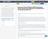
Explore landscape architecture construction materials, methods, and implementation practices through an interactive …
Explore landscape architecture construction materials, methods, and implementation practices through an interactive and simulated environment. Launch the link to view the desktop version or use a virtual reality device. The user can select a particular construction element to view real-life construction videos, 2D construction drawings, and construction phases through 3D representations. Be sure and notice the stormwater drainage animation located at the center of the courtyard with realistic sounds of rain and thunder. Videos and 2D construction drawings combined with the VR environment will allow users to get a realistic experience without physically being at a specific site.
This course provides a foundation to the design of the environment from …
This course provides a foundation to the design of the environment from the scale of the object, to the building to the larger territory. The design disciplines of architecture as well as urbanism and landscape are examined in context of the larger influence of the arts and sciences. Students are expected to develop skills in thinking and analysis, spatial representation, and design methodologies. Through lectures and design exercises, students are provided an opportunity to establish a reference for understanding the discipline of architecture and environmental design, and are given an introduction to design fundamentals and the design process.
This seminar explores “land” as a genre, theme, and medium of art …
This seminar explores “land” as a genre, theme, and medium of art and architecture of the last five decades. Focusing largely on work within the boundaries of the United States, the course seeks to understand how the use of land in art and architecture is bound into complicated entanglements of property and power, the inheritances of non-U.S. traditions, and the violence of colonial ambitions. The term “landscape” is variously deployed in the service of a range of political and philosophical positions.
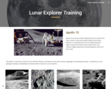
The Apollo 15 astronauts were trained in geology and sampling techniques. Complete …
The Apollo 15 astronauts were trained in geology and sampling techniques. Complete your own geology training by completing these activities to become a Lunar Explorer.
Regolith slides and activity that explore how regolith is created and its …
Regolith slides and activity that explore how regolith is created and its presence on the Earth, the Moon, and Mars. These slides support the Lunar Explorer Training Unit
What is a city? What shapes it? How does its history influence …
What is a city? What shapes it? How does its history influence future development? How do physical form and institutions vary from city to city and how are these differences significant? How are cities changing and what is their future? This course will explore these and other questions, with emphasis upon twentieth-century American cities. A major focus will be on the physical form of cities—from downtown and inner-city to suburb and edge city—and the processes that shape them.
These questions and more are explored through lectures, readings, workshops, field trips, and analysis of particular places, with the city itself as a primary text. In light of the 2016 centennial of MIT’s move from Boston to Cambridge, the 2015 iteration of the course focused on MIT’s original campus in Boston’s Back Bay, and the university’s current neighborhood in Cambridge. Short field assignments, culminating in a final project, will provide students opportunities to use, develop, and refine new skills in “reading” the city.
Class website: The Once & Future City What is a city? What …
Class website: The Once & Future City What is a city? What shapes it? How does its history influence future development? How do physical form and institutions vary from city to city and how are these differences significant? How are cities changing and what is their future? This course will explore these and other questions, with emphasis upon twentieth-century American cities. A major focus will be on the physical form of cities—from downtown and inner-city to suburb and edge city—and the processes that shape them. These questions and more are explored through lectures, readings, workshops, field trips, and analysis of particular places, with the city itself as a primary text. In light of the 2016 centennial of MIT's move from Boston to Cambridge, the 2015 iteration of the course focused on MIT's original campus in Boston's Back Bay, and the university's current neighborhood in Cambridge. Short field assignments, culminating in a final project, will provide students opportunities to use, develop, and refine new skills in "reading" the city.
In this lesson, students learn about major landforms (e.g., mountains, rivers, plains, …
In this lesson, students learn about major landforms (e.g., mountains, rivers, plains, valleys, canyons and plateaus) and how they occur on the Earth's surface. They learn about the civil and geotechnical engineering applications of geology and landforms, including the design of transportation systems, mining, mapping and measuring natural hazards.
No restrictions on your remixing, redistributing, or making derivative works. Give credit to the author, as required.
Your remixing, redistributing, or making derivatives works comes with some restrictions, including how it is shared.
Your redistributing comes with some restrictions. Do not remix or make derivative works.
Most restrictive license type. Prohibits most uses, sharing, and any changes.
Copyrighted materials, available under Fair Use and the TEACH Act for US-based educators, or other custom arrangements. Go to the resource provider to see their individual restrictions.