By far most field trips in structural geology and regional tectonics do …
By far most field trips in structural geology and regional tectonics do NOT take place in large urban centers with a trip focus on mitigation of hazards. What is described here is an example of the instructional and learning opportunities associated with active tectonic examination of large population centers.
ACTIVE TECTONICS, HAZARDS, ACTIVE TECTONICS AND SOCIETY, URBAN GEOLOGY, EARTHQUAKES
(Note: this resource was added to OER Commons as part of a batch upload of over 2,200 records. If you notice an issue with the quality of the metadata, please let us know by using the 'report' button and we will flag it for consideration.)
At the beginning of the course, each student is assigned a unique …
At the beginning of the course, each student is assigned a unique blob - or a piece of material of a particular shape with specific material properties (density, bulk modulus, composition, viscosity, volatile content, etc) that is residing within the mantle at a specific environment (depth, pressure, temperature). Then as the semester continues as a topic is covered the student must assess (either quantitatively or qualitatively) what observable would be associated with their blob (for example, gravity anomalies, geoid anomalies, surface expressions, seismic tomography, phase transition topography). The student then develops a portfolio of their blob and its observables to then present at the end of the course with an explanation/interpretation for the source of the blob culiminating at building a geo-story around their anomaly.
Some blobs could be amorphous anomalies whereas other could have physical significance (though best not to tell the students ahead of time so they can make their own discovery as to what the blob is or isn't) such as subducted slabs at the CMB (or 660 km), plumes, lithospheric drip, lithospheric root, or a boring typical piece of the mantle.
(Note: this resource was added to OER Commons as part of a batch upload of over 2,200 records. If you notice an issue with the quality of the metadata, please let us know by using the 'report' button and we will flag it for consideration.)
This activity has students determine the angle of subduction using GeoMapApp. Students …
This activity has students determine the angle of subduction using GeoMapApp. Students use datasets available within GeoMapApp to examine the influence of the age of oceanic lithosphere and convergence rate on the angle of subduction. These datasets include: earthquakes (depth, magnitude, etc), subduction interface (based on earthquake data), convergence rate, and age of oceanic lithosphere.
(Note: this resource was added to OER Commons as part of a batch upload of over 2,200 records. If you notice an issue with the quality of the metadata, please let us know by using the 'report' button and we will flag it for consideration.)
This course explores the physical processes that control Earth's atmosphere, ocean, and …
This course explores the physical processes that control Earth's atmosphere, ocean, and climate. Quantitative methods for constructing mass and energy budgets. Topics include clouds, rain, severe storms, regional climate, the ozone layer, air pollution, ocean currents and productivity, the seasons, El Nio, the history of Earth's climate, global warming, energy, and water resources.
Teach students about P-waves and S-waves by having them model them with …
Teach students about P-waves and S-waves by having them model them with their own bodies.
(Note: this resource was added to OER Commons as part of a batch upload of over 2,200 records. If you notice an issue with the quality of the metadata, please let us know by using the 'report' button and we will flag it for consideration.)
Click to watch Alain Plattner discuss his activity or watch the full webinar.We use MATLAB functions available from https://github.com/NSGeophysics/Seism-O to simulate the superimposition of different seismic waves recorded in a simple near-surface geophysics setting. The choice of the geophone layout influences how easy it is to discern the different wave types, which is crucial for the success of a near-surface seismics survey. Students learn which parameters they should try to estimate before the survey, why these parameters are crucial, and how they influence the setup of the survey.
(Note: this resource was added to OER Commons as part of a batch upload of over 2,200 records. If you notice an issue with the quality of the metadata, please let us know by using the 'report' button and we will flag it for consideration.)
This course introduces students to climate studies, including beginnings of the solar …
This course introduces students to climate studies, including beginnings of the solar system, time scales, and climate in human history. It is offered to both undergraduate and graduate students with different requirements.
Numerical models are widely used to simulate systems ranging from climate to …
Numerical models are widely used to simulate systems ranging from climate to traffic jams, yet a high percentage of college-level students have little awareness of how they are constructed and their limitations. This activity is intended to introduce students to the construction and use of a simple conservation equation model using MATLAB. Students will construct, with the help of the instructor, a MATLAB script to simulate inputs and outputs to and from a water tank and the tracking of water volume through time. The activity includes calibration and verification of their model using data on flows observed in the water tank.
(Note: this resource was added to OER Commons as part of a batch upload of over 2,200 records. If you notice an issue with the quality of the metadata, please let us know by using the 'report' button and we will flag it for consideration.)
This lab utilizes the computer program, Excel. In this exercise students will …
This lab utilizes the computer program, Excel. In this exercise students will generate synthetic data sets based on a simplified model of daily high temperatures in Boone, NC and apply several filtering techniques to the data. A key to this lab is that the students must use Excel in an efficient manner; otherwise, this exercise may take a long time to complete. Thus, the synthetic data sets are intentionally large in size. The overarching purpose of this lab is two-fold: 1) Perform some quantitative data processing and determine the effectiveness of several types of simple mathematical noise filters, and 2) Make a professional interpretation and recommendation based on quantitative results.
(Note: this resource was added to OER Commons as part of a batch upload of over 2,200 records. If you notice an issue with the quality of the metadata, please let us know by using the 'report' button and we will flag it for consideration.)
This 3-hour hands-on guided-discovery lab activity teaches students the concepts of density, …
This 3-hour hands-on guided-discovery lab activity teaches students the concepts of density, buoyancy, thermal expansion and convection.
(Note: this resource was added to OER Commons as part of a batch upload of over 2,200 records. If you notice an issue with the quality of the metadata, please let us know by using the 'report' button and we will flag it for consideration.)
This module addresses the problem of how to determine the density of …
This module addresses the problem of how to determine the density of the earth and has students do some field experiments to get the data they need to answer the problem.
(Note: this resource was added to OER Commons as part of a batch upload of over 2,200 records. If you notice an issue with the quality of the metadata, please let us know by using the 'report' button and we will flag it for consideration.)
In this activity, students measure the densities of samples of granite, basalt, …
In this activity, students measure the densities of samples of granite, basalt, peridotite/dunite, and an iron meteorite, which are used as representatives of the various layers of the Earth (crust, mantle, core). The samples are weighed to determine their mass, and the Archimedes Principle is used to determine volume. From these two properties, they calculate density, compare it to accepted values presented in the discussion, and answer questions about their observations.
This module addresses the real problem of determining the density of the …
This module addresses the real problem of determining the density of the Earth and invites the student to figure out how to solve the problem.
(Note: this resource was added to OER Commons as part of a batch upload of over 2,200 records. If you notice an issue with the quality of the metadata, please let us know by using the 'report' button and we will flag it for consideration.)
A homework/classroom activity where students collect historical earthquake information and use it …
A homework/classroom activity where students collect historical earthquake information and use it to forecast the probability of larger earthquakes.
(Note: this resource was added to OER Commons as part of a batch upload of over 2,200 records. If you notice an issue with the quality of the metadata, please let us know by using the 'report' button and we will flag it for consideration.)
DATA: Global Digital Elevation Model (DEM) TOOLS: GeoMapApp, Spreadsheet SUMMARY: Use GeoMapApp …
DATA: Global Digital Elevation Model (DEM) TOOLS: GeoMapApp, Spreadsheet SUMMARY: Use GeoMapApp to search for evidence of glacial expansion and retreat. Produce a research report of your findings modeled on peer-reviewed papers in the field of glaciology.
(Note: this resource was added to OER Commons as part of a batch upload of over 2,200 records. If you notice an issue with the quality of the metadata, please let us know by using the 'report' button and we will flag it for consideration.)
DATA: Seismic Wave Model Output. TOOLS: My World GIS, Microsoft Excel. SUMMARY: …
DATA: Seismic Wave Model Output. TOOLS: My World GIS, Microsoft Excel. SUMMARY: Examine seismic wave data in a Geographic Information System (GIS). Analyze wave velocities to infer the depth of the crust-mantle boundary.
(Note: this resource was added to OER Commons as part of a batch upload of over 2,200 records. If you notice an issue with the quality of the metadata, please let us know by using the 'report' button and we will flag it for consideration.)
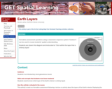
Formative assessment questions using a classroom response system ("clickers") can be used …
Formative assessment questions using a classroom response system ("clickers") can be used to reveal students' spatial understanding. Students are shown this diagram and instructed to "Click within the layer that is entirely liquid."
(Note: this resource was added to OER Commons as part of a batch upload of over 2,200 records. If you notice an issue with the quality of the metadata, please let us know by using the 'report' button and we will flag it for consideration.)
This video segment adapted from NOVA tells the tragic story of two …
This video segment adapted from NOVA tells the tragic story of two Japanese seismologists who disagreed about the threat of earthquakes in the early twentieth century. Today, seismologists in California offer residents a probability of risk that an earthquake might occur.
This student homework and problem set has students quantitatively earthquake hazard, shaking …
This student homework and problem set has students quantitatively earthquake hazard, shaking and damage.
(Note: this resource was added to OER Commons as part of a batch upload of over 2,200 records. If you notice an issue with the quality of the metadata, please let us know by using the 'report' button and we will flag it for consideration.)
In this video segment adapted from NOVA, animations are used to show …
In this video segment adapted from NOVA, animations are used to show how the hills around Los Angeles were formed by earthquakes at small thrust faults that extend outward from the larger San Andreas fault.
No restrictions on your remixing, redistributing, or making derivative works. Give credit to the author, as required.
Your remixing, redistributing, or making derivatives works comes with some restrictions, including how it is shared.
Your redistributing comes with some restrictions. Do not remix or make derivative works.
Most restrictive license type. Prohibits most uses, sharing, and any changes.
Copyrighted materials, available under Fair Use and the TEACH Act for US-based educators, or other custom arrangements. Go to the resource provider to see their individual restrictions.