The goal of this virtual field trip to Iridium Hill, Montana is …
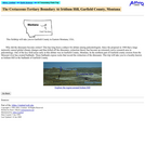
The goal of this virtual field trip to Iridium Hill, Montana is to investigate the disappearance of dinosaur fossils above the Cretaceous/ Tertiary boundary. The site provides rock outcrop photos of Cretaceous and Tertiary strata (Hell Creek and Fort Union Formations), stratigraphic sections and supporting text for this classic iridium-bearing locality. Topics include the K/T boundary, iridium concentrations, stratigraphy, sedimentology and, fluvial and lacustrine depositional environments.
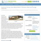
Students receive a "Dear Colleague" letter requesting the review of a journal …
Students receive a "Dear Colleague" letter requesting the review of a journal article in the same format as would be received from an Assistant Editor of a major scholarly journal. The letter outlines the requirements of the review and the due date. Students also receive the review forms typically provided by a given journal (I've provided forms from the Geological Society of America Bulletin and American Mineralogist for use in an upper division course in Mineralogy, Igneous and Metamorphic Petrology. The GSA Bulletin form is better suited for manuscripts that report on articles that have a significant field or tectonic component; the American Mineralogist form is better suited for articles that focus on more analytical, theoretical, or computational applications in mineralogy and petrology.
In an upper division petrology class, I typically select articles for review that integrate numerous aspects of topics we've recently covered in class; tectonic setting, field relations, petrography, whole-rock geochemistry, geo- and thermochronology, mineral chemistry (for PTt calculations), stable isotope geochemistry, etc. My goal is to help students see how these multiple lines of evidence must be integrated into a coherent geologic interpretation of geologic process or history.
Modify the letter with the request for review and review forms to emphasize the particular course goals, content, and expectations for your own course.
(Note: this resource was added to OER Commons as part of a batch upload of over 2,200 records. If you notice an issue with the quality of the metadata, please let us know by using the 'report' button and we will flag it for consideration.)
This exercise is designed to help students understand relationships among external morphology …
This exercise is designed to help students understand relationships among external morphology of crystals (their shape and faces), internal structure (unit cell shape, edge measurements, and volume), Hermann-Mauguin notation for the 32 crystal classes, and Miller Indices of forms and faces.
The example and four crystal measurement problems have been drawn using the computer program SHAPE (see both Brock and Velbel, this volume). Both a single drawing and stereo pair are given for each problem. The stereo pair drawings can be used with the normal stereoscope used to read air photographs. The interfacial angles were calculated by the SHAPE program. If you have access to SHAPE you can design other crystal problems or have students generate the crystal drawing on the computer and then make the calculations ask for in this exercise.
(Note: this resource was added to OER Commons as part of a batch upload of over 2,200 records. If you notice an issue with the quality of the metadata, please let us know by using the 'report' button and we will flag it for consideration.)
In this video segment adapted from NOVA, scientists search for carbonized remains …
In this video segment adapted from NOVA, scientists search for carbonized remains of plants preserved in lava flows to find out how long it has taken rain forests on Hawaii to regenerate after a volcanic eruption.
This activity modifies a typical density laboratory exercise to fit within a …
This activity modifies a typical density laboratory exercise to fit within a lecture session. Students are asked to compare the densities of six different rocks/minerals collected from six different environments. Based on the brief description of each rock the students are asked to first predict which rock has the highest density and which rock has the lowest density. The students are then asked to construct a hypothesis and test their hypothesis by calculating the density of the rocks. Students are then asked to apply information from lecture to place each rock in the appropriate layer of the Earth.
(Note: this resource was added to OER Commons as part of a batch upload of over 2,200 records. If you notice an issue with the quality of the metadata, please let us know by using the 'report' button and we will flag it for consideration.)
In this activity, students measure the densities of samples of granite, basalt, …
In this activity, students measure the densities of samples of granite, basalt, peridotite/dunite, and an iron meteorite, which are used as representatives of the various layers of the Earth (crust, mantle, core). The samples are weighed to determine their mass, and the Archimedes Principle is used to determine volume. From these two properties, they calculate density, compare it to accepted values presented in the discussion, and answer questions about their observations.
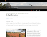
This site from the National Park Service briefly addresses the geology of …
This site from the National Park Service briefly addresses the geology of Devil's Tower. The evolution of various theories on the formation of the tower are discussed. A slide show of the emplacement of the tower is also available.
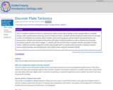
This is a student-centered activity for a synchronous online course where students …
This is a student-centered activity for a synchronous online course where students access google slides to complete during a video conferencing session (eg. Zoom) in break out rooms. Students will be introduced to plate tectonics through a series of scaffolded mini activities which includes: active learning jigsaws, group research and presentations, and assessments. Students will familiarize themselves with types of plate boundaries as well as features found at plate boundaries using the Jules Verne Voyager Jr. website, and will use GPS data to visualize direction and speed of plate motion. Additional activities suggested include using Google Earth to visualize plate boundaries, drawing a transect across a plate boundary, and calculating the rate of plate motion using the Hawaiian Islands.
(Note: this resource was added to OER Commons as part of a batch upload of over 2,200 records. If you notice an issue with the quality of the metadata, please let us know by using the 'report' button and we will flag it for consideration.)
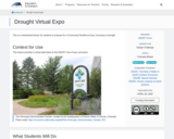
Students gain a basic understanding of the properties of media soil, sand, …
Students gain a basic understanding of the properties of media soil, sand, compost, gravel and how these materials affect the movement of water (infiltration/percolation) into and below the surface of the ground. They learn about permeability, porosity, particle size, surface area, capillary action, storage capacity and field capacity, and how the characteristics of the materials that compose the media layer ultimately affect the recharging of groundwater tables. They test each type of material, determining storage capacity, field capacity and infiltration rates, seeing the effect of media size on infiltration rate and storage. Then teams apply the testing results to the design their own material mixes that best meet the design requirements. To conclude, they talk about how engineers apply what students learned in the activity about the infiltration rates of different soil materials to the design of stormwater management systems.
This is a classroom activity in which students develop understanding of the …
This is a classroom activity in which students develop understanding of the rock cycle using wax crayons to model the processes that form the 3 types of rock; sedimentary, igneous & metamorphic.
In this activity, students play the roles of "time travel agents" creating …
In this activity, students play the roles of "time travel agents" creating an advertisement for a geologic time period which has been assigned to them. They will use the Earth Science Reference Tables (available on the internet) to learn some basic facts about their assigned period. A rubric for assessing student understanding is provided.
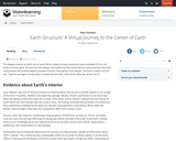
This lesson discusses the interior structure of the earth as defined by …
This lesson discusses the interior structure of the earth as defined by research on the behavior of seismic waves as they move through the layers inside of the planet. The lesson details both compositional layers as well as mechanical layers.
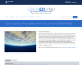
Rapid changes at Earth's surface, largely in response to human activity, have …
Rapid changes at Earth's surface, largely in response to human activity, have led to the realization that fundamental questions remain to be answered regarding the natural functioning of the Critical Zone, the thin veneer at Earth's surface where the atmosphere, lithosphere, hydrosphere and biosphere interact. EARTH 530 will introduce you to the basics necessary for understanding Earth surface processes in the Critical Zone through an integration of various scientific disciplines. Those who successfully complete EARTH 530 will be able to apply their knowledge of fundamental concepts of Earth surface processes to understanding outstanding fundamental questions in Critical Zone science and how their lives are intimately linked to Critical Zone health.
Earth ƒ??was formed approximately 4.6 billion years ago, likely as the result …
Earth ƒ??was formed approximately 4.6 billion years ago, likely as the result of a supernova (star explosion). The debris from this explosion began to collapse in on itself due to gravity, forming the sun. Gravity continued to draw the remaining particles together, clumping them into larger bodies, ultimately forming Earth and the other planets in our solar system. Created by Sal Khan.
The earthquake game teaches how scientists learn about real earthquakes. The player …
The earthquake game teaches how scientists learn about real earthquakes. The player must learn about S& P waves and triangulation to determine the epicenter of the earthquake that hit the cities.
This video segment adapted from NOVA tells the tragic story of two …
This video segment adapted from NOVA tells the tragic story of two Japanese seismologists who disagreed about the threat of earthquakes in the early twentieth century. Today, seismologists in California offer residents a probability of risk that an earthquake might occur.
This lesson on earthquakes is based on naturalist John Muir's experiences with …
This lesson on earthquakes is based on naturalist John Muir's experiences with two significant earthquakes, the 1872 earthquake on the east side of the Sierra Nevada Mountains, and the Great San Francisco Earthquake of 1906. Students will learn to explain that earthquakes are sudden motions along breaks in the crust called faults, and list the major geologic events including earthquakes, volcanic eruptions and mountain building, which are the result of crustal plate motions. A downloadable, printable version (PDF) of the lesson plan is available.
Students study how geology relates to the frequency of large-magnitude earthquakes in …
Students study how geology relates to the frequency of large-magnitude earthquakes in Japan. Using the online resources provided through the Earthquakes Living Lab, students investigate reasons why large earthquakes occur in this region, drawing conclusions from tectonic plate structures and the locations of fault lines. Working in pairs, students explore the 1995 Kobe earthquake, why it happened and the destruction it caused. Students also think like engineers to predict where other earthquakes are likely to occur and what precautions might be taken. A worksheet serves as a student guide for the activity.
Students examine the effects of geology on earthquake magnitudes and how engineers …
Students examine the effects of geology on earthquake magnitudes and how engineers anticipate and prepare for these effects. Using information provided through the Earthquakes Living Lab interface, students investigate how geology, specifically soil type, can amplify the magnitude of earthquakes and their consequences. Students look in-depth at the historical 1906 San Francisco earthquake and its destruction thorough photographs and data. They compare the 1906 California earthquake to another historical earthquake in Kobe, Japan, looking at the geological differences and impacts in the two regions, and learning how engineers, geologists and seismologists work to predict earthquakes and minimize calamity. A worksheet serves as a student guide for the activity.
No restrictions on your remixing, redistributing, or making derivative works. Give credit to the author, as required.
Your remixing, redistributing, or making derivatives works comes with some restrictions, including how it is shared.
Your redistributing comes with some restrictions. Do not remix or make derivative works.
Most restrictive license type. Prohibits most uses, sharing, and any changes.
Copyrighted materials, available under Fair Use and the TEACH Act for US-based educators, or other custom arrangements. Go to the resource provider to see their individual restrictions.