This video segment adapted from NOVA relates the dramatic story of vulcanologists …
This video segment adapted from NOVA relates the dramatic story of vulcanologists trying to predict the timing of the cataclysmic eruption of Mount Pinatubo in the Philippines.
Students observe an in-classroom visual representation of a volcanic eruption. The water-powered …
Students observe an in-classroom visual representation of a volcanic eruption. The water-powered volcano demonstration is made in advance, using sand, hoses and a waterballoon, representing the main components of all volcanoes. During the activity, students observe, measure and sketch the volcano, seeing how its behavior provides engineers with indicators used to predict an eruption.
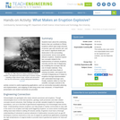
Students learn about the causes, composition and types of volcanoes. They begin …
Students learn about the causes, composition and types of volcanoes. They begin with an overview of the Earth's interior and how volcanoes form. Once students know about how a volcano functions, they learn how engineers predict eruptions. In a class demonstration, students watch and measure a mock volcanic eruption and observe the phases of an eruption, seeing how a volcano gets its shape and provides us with clues to predict a blast.
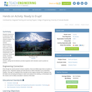
Students learn about the underlying factors that can contribute to Plinian eruptions …
Students learn about the underlying factors that can contribute to Plinian eruptions (which eject large amounts of pumice, gas and volcanic ash, and can result in significant death and destruction in the surrounding environment), versus more gentle, effusive eruptions. Students explore two concepts related to the explosiveness of volcanic eruptions, viscosity and the rate of degassing, by modelling the concepts with the use of simple materials. They experiment with three fluids of varying viscosities, and explore the concept of degassing as it relates to eruptions through experimentation with carbonated beverage cans. Finally, students reflect on how the scientific concepts covered in the activity connect to useful engineering applications, such as community evacuation planning and implementation, and mapping of safe living zones near volcanoes. A PowerPoint® presentation and student worksheet are provided.
No restrictions on your remixing, redistributing, or making derivative works. Give credit to the author, as required.
Your remixing, redistributing, or making derivatives works comes with some restrictions, including how it is shared.
Your redistributing comes with some restrictions. Do not remix or make derivative works.
Most restrictive license type. Prohibits most uses, sharing, and any changes.
Copyrighted materials, available under Fair Use and the TEACH Act for US-based educators, or other custom arrangements. Go to the resource provider to see their individual restrictions.