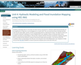
The flow or discharge value in a river does not mean much to a lay person or a decision maker because this flow can be insignificant on a big river or can be dangerous on a small creek. Thus, we must know how to translate this flow value into the water depth, velocity, and the corresponding extent to understand its impact. The objective of this unit is to perform hydraulic modeling on a reach of Wabash River near Lafayette, Indiana, to estimate water surface elevation and extent corresponding to a 100 year flow. Students will learn the basics of hydraulic modeling using HEC-RAS to simulate the flow hydraulics using one-dimensional steady state assumption. The outcome will be the inundation extent corresponding to the 100-year event along the reach of the Wabash River near Lafayette, IN. Make sure you have HEC-RAS available on school or personal computers prior to the start of the unit.
- Subject:
- Geology
- Physical Geography
- Physical Science
- Material Type:
- Activity/Lab
- Module
- Provider:
- Science Education Resource Center (SERC) at Carleton College
- Provider Set:
- Teach the Earth
- Author:
- James McNamara
- Venkatesh Merwade
- Date Added:
- 01/20/2023