This resource is a video abstract of a research paper created by …
This resource is a video abstract of a research paper created by Research Square on behalf of its authors. It provides a synopsis that's easy to understand, and can be used to introduce the topics it covers to students, researchers, and the general public. The video's transcript is also provided in full, with a portion provided below for preview:
"In northern ecosystems, winter carbon loss is estimated to exceed growing season carbon uptake, primarily because of microbial decomposition. Viruses in soil alter microbial carbon cycling by affecting metabolic pathways and killing their hosts, but whether viruses are active under anoxic and sub-freezing soil conditions remains unknown. To find out, a recent study used stable isotope probing (SIP) targeted metagenomics to investigate active microbes in Alaskan Arctic peat soils under simulated winter conditions, with a particular focus on viruses and virus-host dynamics. Overall, 46 bacterial and 243 viral populations actively took up soil water labeled with ¹⁸O and respired CO₂. Active bacteria represented a small proportion of the total microbial community but were able to ferment and degrade organic matter. In contrast, a large diversity of viruses were found to be active, one-third of which were linked to active bacteria..."
The rest of the transcript, along with a link to the research itself, is available on the resource itself.
As emissions of heat-trapping bases accumulate in our atmosphere, Earth's polar regions …
As emissions of heat-trapping bases accumulate in our atmosphere, Earth's polar regions are warming more quickly than at lower latitudes. The rapid environmental changes that result from this warming can have a significant impact on the physical and mental health of rural Alaskans: unpredictable weather and changes in the seasons have made harvesting food more difficult, hazardous, and stressful. The risk of physical injury has also increased, as poor ice, extreme weather, and coastal erosion bring new travel hazards. Increasingly difficult harvest conditions for fish, shellfish, berries, caribou, and sea mammals have also increased concerns about food security. Additionally, declines in snow pack, the threat of drought, changes in lake and river conditions, and damage and disruptions to community water systems have prompted concerns of water security. The climate-related challenge faced by Alaskas tribal health system is to recognize new health stressors and community vulnerabilities, and then find healthy adaptation strategies in an increasingly uncertain future.
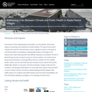
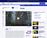
This video from First Alaskans Institute spotlights the Alaska Native community of …
This video from First Alaskans Institute spotlights the Alaska Native community of St. Paul and its hands-on commitment to care for the land and animals on which it depends.
As reduced sea ice conditions bring increased shipping and development opportunities to …
As reduced sea ice conditions bring increased shipping and development opportunities to the Arctic, Alaska Native Village Corporations are at the table with resource developers, representing the interests of their people and land.
Tribal communities in southeastern Alaska are partnering with federal and state agencies …
Tribal communities in southeastern Alaska are partnering with federal and state agencies to investigate increasing harmful algal bloomsevents that pose human health risks to subsistence harvesters.
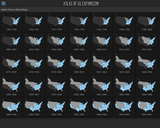
Blue Coral Atlas of US Expansion tells the geographic story of the …
Blue Coral Atlas of US Expansion tells the geographic story of the United States from the original thirteen colonies to today. View all the maps together in a single scroll or choose maps either individually or in series together for a closer look.
Blue Coral Atlas of US Expansion is fully responsive in the web browser for large and small devices in both horizontal and vertical orientations.
In this video adapted from the Arctic Athabaskan Council, learn how warmer …
In this video adapted from the Arctic Athabaskan Council, learn how warmer temperatures in the Arctic are transforming the landscape, triggering a host of effects such as permafrost thawing and insect infestations.
This video adapted from KTOO takes a look at Earth's warming and …
This video adapted from KTOO takes a look at Earth's warming and cooling cycles and the current atypical trend of warming that is impacting the glaciers in Alaska's Inside Passage.
This article describes online artifact collections available through the Arctic Studies Center, …
This article describes online artifact collections available through the Arctic Studies Center, a part of the Smithsonian's National Museum of Natural History. The collection includes artifacts and background information about the peoples of Alaska and Northeast Siberia.
This article profiles Linda Deegan, scientist with the Arctic Long-Term Ecological Research …
This article profiles Linda Deegan, scientist with the Arctic Long-Term Ecological Research site in the Kuparuk River region of Alaska, as she counts and tags Arctic grayling as they migrate from streams to lakes in the fall.
Coastal habitats and archeological sites in western Alaska are at risk from …
Coastal habitats and archeological sites in western Alaska are at risk from coastal erosion. Researchers are documenting current assets and vulnerabilities so managers can make informed decisions.
In this video profile produced for Teachers' Domain, meet teacher Dustin Madden, …
In this video profile produced for Teachers' Domain, meet teacher Dustin Madden, an IŰ__óíupiaq who hopes to inspire students to take an active role in protecting the natural environment by giving them a foundation in math and science.
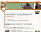
Students experience the excitement of watching live-streaming video of wild bears on …
Students experience the excitement of watching live-streaming video of wild bears on Brooks River in Katmai National Park, Alaska, in order to explore science concepts in the real world. These three lessons, designed for grades 3–5, offer students the opportunity to engage in activities that focus in particular on the inheritance and variation of brown bear traits.
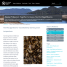
In this video adapted from Bullfrog Films, GwichŰ__Ű__Çin Chief Evon Peter of …
In this video adapted from Bullfrog Films, GwichŰ__Ű__Çin Chief Evon Peter of Arctic Village, Alaska, describes his people's connection to the caribou and their passion to protect Alaska Native land and traditions.
This unit will focus on one very small, but significant area of …
This unit will focus on one very small, but significant area of Alaska: The capitol city of Juneau. Population 32,000, and the only land-locked capitol in the United States. The only way a person can get to Juneau is by boat or plane. No roads lead to Juneau!
Juneau's rich history starts with the rich resources of fur, timber and fish. Then the discovery of gold that started one of the largest gold rush migrations in North America.
Juneau continues to be a central community in Southeast Alaska providing jobs, resources and services to people living within several hundred miles.
This resource is a video abstract of a research paper created by …
This resource is a video abstract of a research paper created by Research Square on behalf of its authors. It provides a synopsis that's easy to understand, and can be used to introduce the topics it covers to students, researchers, and the general public. The video's transcript is also provided in full, with a portion provided below for preview:
"One of the many reasons why a melting planet is a dangerous one is bacteria that break down carbon in soil. Freezing temperatures keep soil carbon locked away from these hungry microbes, but as temperatures rise, that carbon gradually becomes accessible, sending the bacteria into a feeding frenzy and thereby sending harmful carbon dioxide into the atmosphere. To better understand how that process could play out, researchers analyzed soil from the Alaskan tundra. Surprisingly, a 2.2°C increase in temperature was enough to substantially boost microbial activity, with further warming only compounding that effect. The results serve as a grim warning: left unchecked, global warming could have a more profound impact on the health of the planet than previously anticipated..."
The rest of the transcript, along with a link to the research itself, is available on the resource itself.
In this video profile produced for Teachers' Domain, meet La'ona DeWilde, an …
In this video profile produced for Teachers' Domain, meet La'ona DeWilde, an environmental biologist who integrates her Athabascan heritage and her Western scientific training to help remote Alaskan villages address environmental issues.
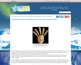
In this video segment adapted from the Alaska Native Heritage Center, discover …
In this video segment adapted from the Alaska Native Heritage Center, discover the connections between Alaska Native subsistence culture and the natural cycle of the seasons.
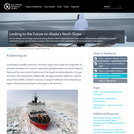
As ice retreats and energy resources along Alaska's North Slope become more …
As ice retreats and energy resources along Alaska's North Slope become more accessible, diverse stakeholders consider potential futures and develop a science-informed view of the implications of development in the region.
Math in a Cultural Context (MCC) is a long-term set of interrelated …
Math in a Cultural Context (MCC) is a long-term set of interrelated sponsored research, funded by the National Science Foundation and the US Department of Education and by support from the University of Alaska Fairbanks. Math in a Cultural Context is a rather extraordinary three decades-long collaboration of educators, Yup’ik elders and teachers, mathematicians and math educators, Alaskan school districts, and more recently includes Greenlandic Inuit, Sami, and Pacific Islander partners. We have had the privilege to learn together and understand how the underlying principles that support everyday practical knowledge can inform teaching and learning in a school context. Central to MCC is its long-term collaboration with Yup’ik elders, teachers, and academics that developed into a vibrant learning community. We are deeply inspired by the steadfast support of so many elders who shared their knowledge. Alaskan school districts and teachers opened their classrooms to MCC as we developed, tested, and revised our materials and pedagogical approach.
No restrictions on your remixing, redistributing, or making derivative works. Give credit to the author, as required.
Your remixing, redistributing, or making derivatives works comes with some restrictions, including how it is shared.
Your redistributing comes with some restrictions. Do not remix or make derivative works.
Most restrictive license type. Prohibits most uses, sharing, and any changes.
Copyrighted materials, available under Fair Use and the TEACH Act for US-based educators, or other custom arrangements. Go to the resource provider to see their individual restrictions.