This resource is a video abstract of a research paper created by …
This resource is a video abstract of a research paper created by Research Square on behalf of its authors. It provides a synopsis that's easy to understand, and can be used to introduce the topics it covers to students, researchers, and the general public. The video's transcript is also provided in full, with a portion provided below for preview:
"Vitamin D guidelines are currently in a state of paralysis. The problem: the numerous competing ways of measuring levels of 25-hydroxyvitamin D, a slightly modified form of vitamin D in the body. This lack of standardization has produced three conflicting sets of guidelines for defining vitamin D status across the globe, those from the UK, the US, and the Endocrine Society. The guidelines from the UK and US set similar standards, defining vitamin D deficiency as 25-hydroxyvitamin D concentrations less than 10 to 12 nanograms per milliliter. This is the standard typically adopted by government-sponsored committees. Non-governmental organizations, however, tend to adopt the guideline set by the Endocrine Society, which defines deficiency as 25-hydroxyvitamin D concentrations less than 20 nanograms per milliliter. Despite a wealth of data on vitamin D and how to measure it, a worldwide consensus on determining vitamin D status remains elusive..."
The rest of the transcript, along with a link to the research itself, is available on the resource itself.
Students learn about the concepts of accuracy and approximation as they pertain …
Students learn about the concepts of accuracy and approximation as they pertain to robotics, gain insight into experimental accuracy, and learn how and when to estimate values that they measure. Students also explore sources of error stemming from the robot setup and rounding numbers.
This 12 session course is designed for the beginning or novice archer …
This 12 session course is designed for the beginning or novice archer and uses recurve indoor target bows and equipment. The purpose of the course is to introduce students to the basic techniques of indoor target archery emphasizing the care and use of equipment, range safety, stance and shooting techniques, scoring and competition.
This resource is a video abstract of a research paper created by …
This resource is a video abstract of a research paper created by Research Square on behalf of its authors. It provides a synopsis that's easy to understand, and can be used to introduce the topics it covers to students, researchers, and the general public. The video's transcript is also provided in full, with a portion provided below for preview:
"Accurate identification of medical alarm sounds can be life-saving, but current standard alarms are difficult to learn. One issue is that these alarms, despite having different melodies, possess highly similar tonal qualities. This makes it hard to distinguish, for example, an alarm indicating an abnormal heart rate from one denoting abnormal oxygen saturation. To ease interpretation, researchers have developed new auditory icon alarms. These real-world sounds are associated with the processes they represent, such as the sound made by pills rattling in a bottle to indicate a drug administration issue or the sound of assisted breathing to denote abnormal ventilation parameters. The intuitive reaction to such sounds should make the icon alarms easier to identify than standard alarms, creating new possibilities to improve patient safety. The team tested the usability of the icons in a simulated intensive care unit..."
The rest of the transcript, along with a link to the research itself, is available on the resource itself.
This resource is a video abstract of a research paper created by …
This resource is a video abstract of a research paper created by Research Square on behalf of its authors. It provides a synopsis that's easy to understand, and can be used to introduce the topics it covers to students, researchers, and the general public. The video's transcript is also provided in full, with a portion provided below for preview:
"Metagenomic analysis frequently plays an important role in development pipelines for human fecal microbiome-related products, but validation and standardization of the methods used to extract DNA and assemble sequence libraries for these studies is currently lacking. To close this gap, researchers recently characterized existing protocols for accuracy and precision. First, they tested the quantification accuracy by using a defined mock community of bacteria. Then, the protocols that performed as expected were evaluated for both within- and inter-laboratory precision metrics. The protocols were also tested against the MOSAIC Standards Challenge samples. Lastly, they defined performance metrics for the recommended protocols to provide best-practice guidance. The uptake of the recommendations generated here should improve reproducibility in human metagenomic research and therefore facilitate development and commercialization of human microbiome-related products..."
The rest of the transcript, along with a link to the research itself, is available on the resource itself.
The purpose of this resource is to quantitatively evaluate the accuracy of …
The purpose of this resource is to quantitatively evaluate the accuracy of a classification system. Students sort birds into three possible classes based on each bird's beak: carnivores, herbivores, and omnivores. Students compare their answers with a given set of validation data.
Student teams design their own booms (bridges) and engage in a friendly …
Student teams design their own booms (bridges) and engage in a friendly competition with other teams to test their designs. Each team strives to design a boom that is light, can hold a certain amount of weight, and is affordable to build. Teams are also assessed on how close their design estimations are to the final weight and cost of their boom "construction." This activity teaches students how to simplify the math behind the risk and estimation process that takes place at every engineering firm prior to the bidding phase when an engineering firm calculates how much money it will take to build the project and then "bids" against other competitors.
Accuracy of measurement in navigation depends very much on the situation. If …
Accuracy of measurement in navigation depends very much on the situation. If a sailor's target is an island 200 km wide, sailing off center by 10 or 20 km is not a major problem. But, if the island were only 1 km wide, it would be missed if off just the smallest bit. Many of the measurements made while navigating involve angles, and a small error in the angle can translate to a much larger error in position when traveling long distances.
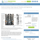
Students create model elevator carriages and calibrate them, similar to the work …
Students create model elevator carriages and calibrate them, similar to the work of design and quality control engineers. Students use measurements from rotary encoders to recreate the task of calibrating elevators for a high-rise building. They translate the rotations from an encoder to correspond to the heights of different floors in a hypothetical multi-story building. Students also determine the accuracy of their model elevators in getting passengers to their correct destinations.
Is Energy and GIS your passion? If so, Energy Industry Applications of …
Is Energy and GIS your passion? If so, Energy Industry Applications of GIS provides students with an in-depth exploration of the complexities of siting decisions in the electricity market. The course introduces a variety of siting challenges that confront the energy industry and its customers and neighbors but focuses on the siting of electrical transmission lines. The course also provides hands-on experience with a common decision support technology, ArcGIS, and considers how the technology may be used to facilitate public participation in siting decisions.
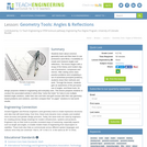
Students learn about common geometry tools and then learn to use protractors …
Students learn about common geometry tools and then learn to use protractors (and Miras, if available) to create and measure angles and reflections. The lesson begins with a recap of the history and modern-day use of protractors, compasses and mirrors. After seeing some class practice problems and completing a set of worksheet-prompted problems, students share their methods and work. Through the lesson, students gain an awareness of the pervasive use of angles, and these tools, for design purposes related to engineering and everyday uses. This lesson prepares students to conduct the associated activity in which they “solve the holes” for hole-in-one multiple-banked angle solutions, make their own one-hole mini-golf courses with their own geometry-based problems and solutions, and then compare their “on paper” solutions to real-world results.
In this lesson, students will investigate error. As shown in earlier activities …
In this lesson, students will investigate error. As shown in earlier activities from navigation lessons 1 through 3, without an understanding of how errors can affect your position, you cannot navigate well. Introducing accuracy and precision will develop these concepts further. Also, students will learn how computers can help in navigation. Often, the calculations needed to navigate accurately are time consuming and complex. By using the power of computers to do calculations and repetitive tasks, one can quickly see how changing parameters likes angles and distances and introducing errors will affect their overall result.
In this activity students practice measuring techniques by measuring different objects and …
In this activity students practice measuring techniques by measuring different objects and distances around the classroom. They practice using different scales of measurement in metric units and estimation.
Students follow weather forecasts to gauge their accuracy and produce a weather …
Students follow weather forecasts to gauge their accuracy and produce a weather report for the class. They develop skills of observation, recording and reporting.
How to teach IELTS: SpeakingThis lesson plan introduces the speaking test and …
How to teach IELTS: SpeakingThis lesson plan introduces the speaking test and its format. It covers the following exam criteria: pronunciation, lexical resource, grammatical range and accuracy, fluency, and coherence. During this lesson, you will also have the chance to practice speaking exercises with your students. Like the listening test, the speaking test is the same for both academic and general tests.If you want additional lesson plans and support, including teachers’ notes, be sure to register for a free Off2Class account.
After differentiating between precision and accuracy, students will perform a lab that …
After differentiating between precision and accuracy, students will perform a lab that helps them learn which lab equipment is appropriate for measuring liquids. Students will then calculate absolute error and percent error.
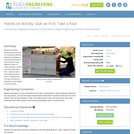
Students learn about catapults, including the science and math concepts behind them, …
Students learn about catapults, including the science and math concepts behind them, as they prepare for the associated activity in which they design, build and test their own catapults. They learn about force, accuracy, precision and angles.
As part of a design challenge, students learn how to use a …
As part of a design challenge, students learn how to use a rotation sensor (located inside the casing of a LEGO® MINDSTORMS ® NXT motor) to measure how far a robot moves with each rotation. Through experimentation and measurement with the sensor, student pairs determine the relationship between the number of rotations of the robot's wheels and the distance traveled by the robot. Then they use this ratio to program LEGO robots to move precise distances in a contest of accuracy. The robot that gets closest to the goal without touching the toy figures at the finish line is the winning programming design. Students learn how rotational sensors measure distance, how mathematics can be used for real-world purposes, and about potential sources of error due to gearing when using rotation sensor readings for distance calculations. They also become familiar with the engineering design process as they engage in its steps, from understanding the problem to multiple test/improve iterations to successful design.
Students learn about the statistical analysis of measurements and error propagation, reviewing …
Students learn about the statistical analysis of measurements and error propagation, reviewing concepts of precision, accuracy and error types. This is done through calculations related to the concept of density. Students work in teams to each measure the dimensions and mass of five identical cubes, compile the measurements into small data sets, calculate statistics including the mean and standard deviation of these measurements, and use the mean values of the measurements to calculate density of the cubes. Then they use this calculated density to determine the mass of a new object made of the same material. This is done by measuring the appropriate dimensions of the new object, calculating its volume, and then calculating its mass using the density value. Next, the mass of the new object is measured by each student group and the standard deviation of the measurements is calculated. Finally, students determine the accuracy of the calculated mass by comparing it to the measured mass, determining whether the difference in the measurements is more or less than the standard deviation.
No restrictions on your remixing, redistributing, or making derivative works. Give credit to the author, as required.
Your remixing, redistributing, or making derivatives works comes with some restrictions, including how it is shared.
Your redistributing comes with some restrictions. Do not remix or make derivative works.
Most restrictive license type. Prohibits most uses, sharing, and any changes.
Copyrighted materials, available under Fair Use and the TEACH Act for US-based educators, or other custom arrangements. Go to the resource provider to see their individual restrictions.